The Great Lakes
Numéro d’image : 11673531
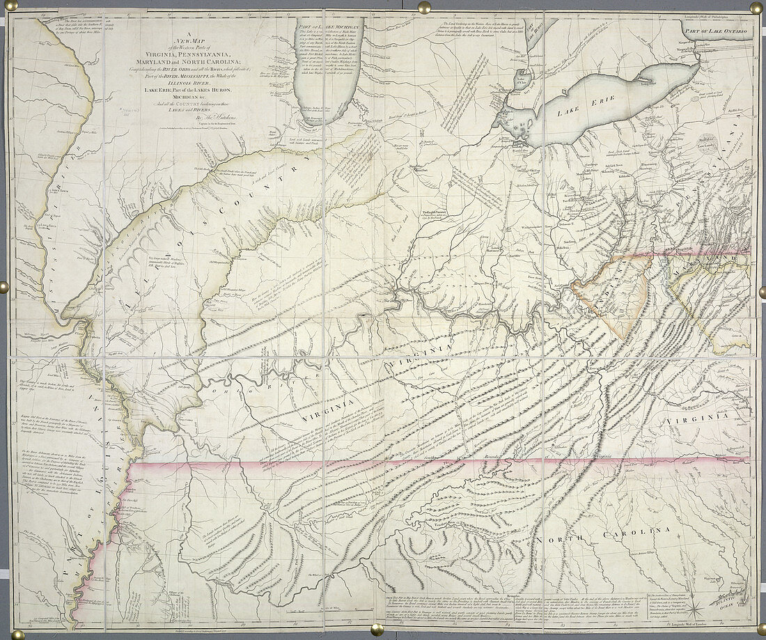
| The Great Lakes,In the map are shown Lake Erie,and part of the Lakes Huron,Michigan and Ontario. Also,part of the River Mississippi,and the whole of the River Illinois. Image taken from A new Map of the Western Parts of Virginia,Pennsylvania,Maryland,and North Carolina Originally published in 1778. Illustrated by Thomas Hutchins | |
| Licence : | Droits gérés |
| Crédit: | Science Photo Library / British Library |
| Taille de l’image : | 4573 px × 3821 px |
| Model Release : | Non requis |
| Property Release : | Non requis |
| Restrictions : | - |
Prix pour cette image À partir de 45 €
Produit vendu
(Calendrier, Carte postale, Carte de vœux, Impression sur textile, Packaging etc)
À partir de 45 €
Usage commercial
(Affichage, Annonce presse, Annonce TV, Carte, Digital - hors rés. sociaux, Digital - rés. sociaux etc)
À partir de 45 €
Éditorial
(Digital, Journal, Livre, Livre pratique, Magazine, Télévision etc)
À partir de 60 €
Usage non-commercial
(Digital - hors rés. sociaux, Digital - rés. sociaux etc)
À partir de 120 €