Plan of encampments in London
Numéro d’image : 11673467
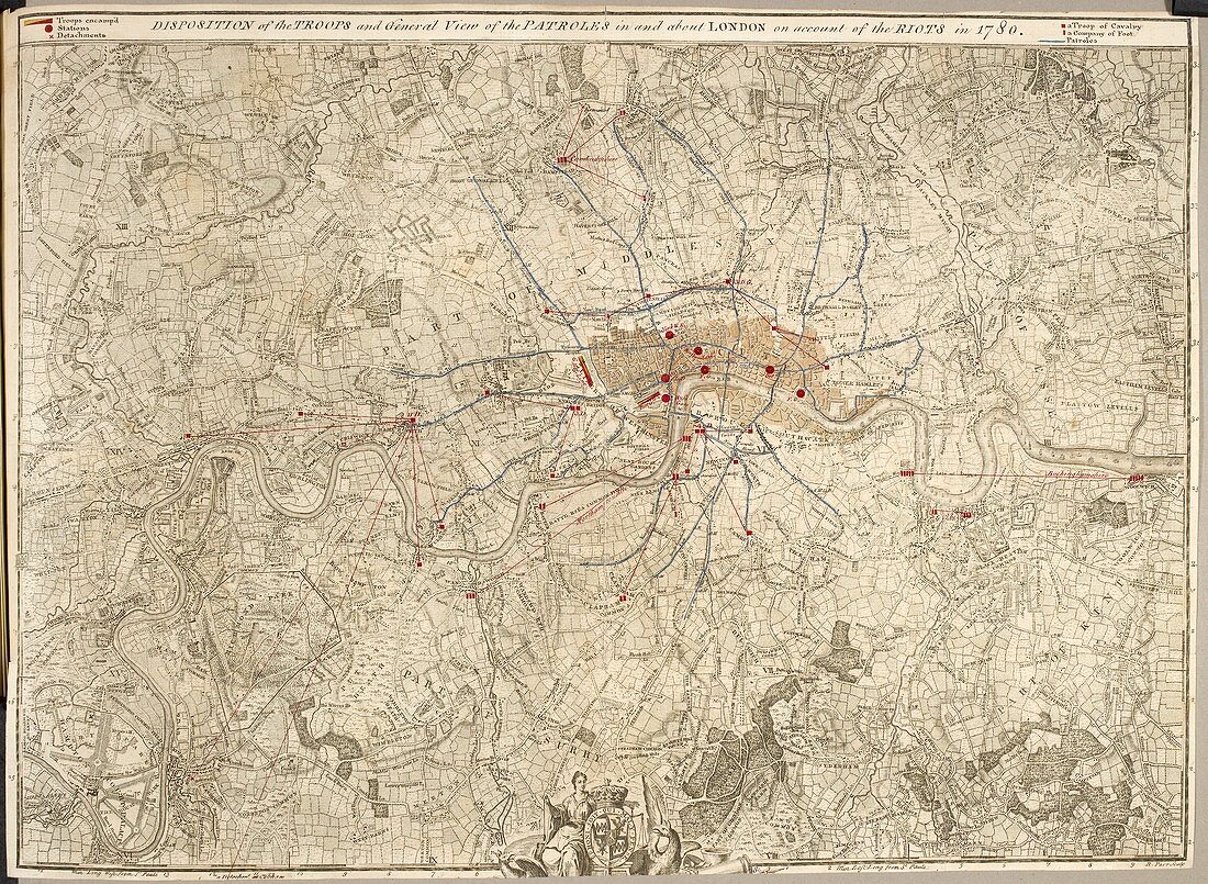
| Plan of encampments in London (Whole map) Printed map of London and the surrounding area from Harrow and Tottenham to Hampton Court and Bromley; with annotations showing the disposition the troops and general route of the patrols after the Gordon Riots of 1780. Dedicated to King George III Image taken from Plans of Encampments from 1778 to 1782. Originally published in England; 1762 | |
| Licence : | Droits gérés |
| Crédit: | Science Photo Library / British Library |
| Taille de l’image : | 4886 px × 3577 px |
| Model Release : | Non requis |
| Property Release : | Non requis |
| Restrictions : | - |
Prix pour cette image À partir de 45 €
Produit vendu
(Calendrier, Carte postale, Carte de vœux, Impression sur textile, Packaging etc)
À partir de 45 €
Usage commercial
(Affichage, Annonce presse, Annonce TV, Carte, Digital - hors rés. sociaux, Digital - rés. sociaux etc)
À partir de 45 €
Éditorial
(Digital, Journal, Livre, Livre pratique, Magazine, Télévision etc)
À partir de 60 €
Usage non-commercial
(Digital - hors rés. sociaux, Digital - rés. sociaux etc)
À partir de 120 €