Chart of Red Sea and Arabia
Numéro d’image : 11673414
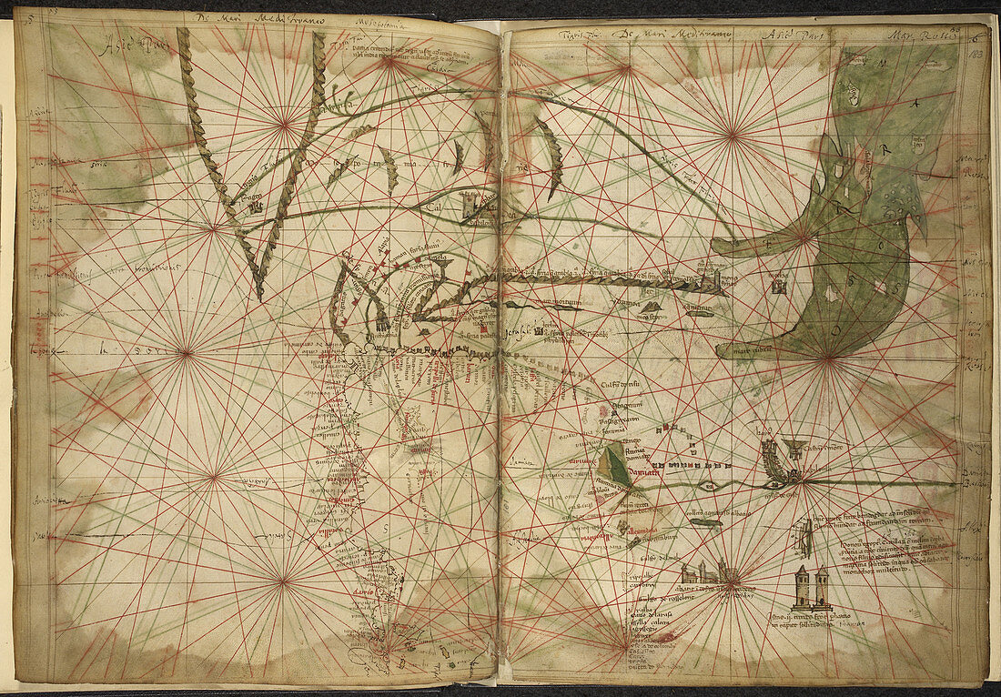
| Chart of Red Sea and Arabia (Whole chart Chart of the coast of Egypt northern part of the Red Sea Arabia and rivers Tigris and Euphrates Image taken from Maps for the Liber Secretorum Fidelium Crucis. Originally published in Italy (Venice); circa 1320-1325. Author Pietro Vesconte,Illustrated by Pietro Vesconte | |
| Licence : | Droits gérés |
| Crédit: | Science Photo Library / British Library |
| Taille de l’image : | 5008 px × 3489 px |
| Model Release : | Non requis |
| Property Release : | Non requis |
| Restrictions : | - |
Prix pour cette image À partir de 45 €
Produit vendu
(Calendrier, Carte postale, Carte de vœux, Impression sur textile, Packaging etc)
À partir de 45 €
Usage commercial
(Affichage, Annonce presse, Annonce TV, Carte, Digital - hors rés. sociaux, Digital - rés. sociaux etc)
À partir de 45 €
Éditorial
(Digital, Journal, Livre, Livre pratique, Magazine, Télévision etc)
À partir de 60 €
Usage non-commercial
(Digital - hors rés. sociaux, Digital - rés. sociaux etc)
À partir de 120 €