Anglo-Saxon world map,11th Century
Numéro d’image : 11673346
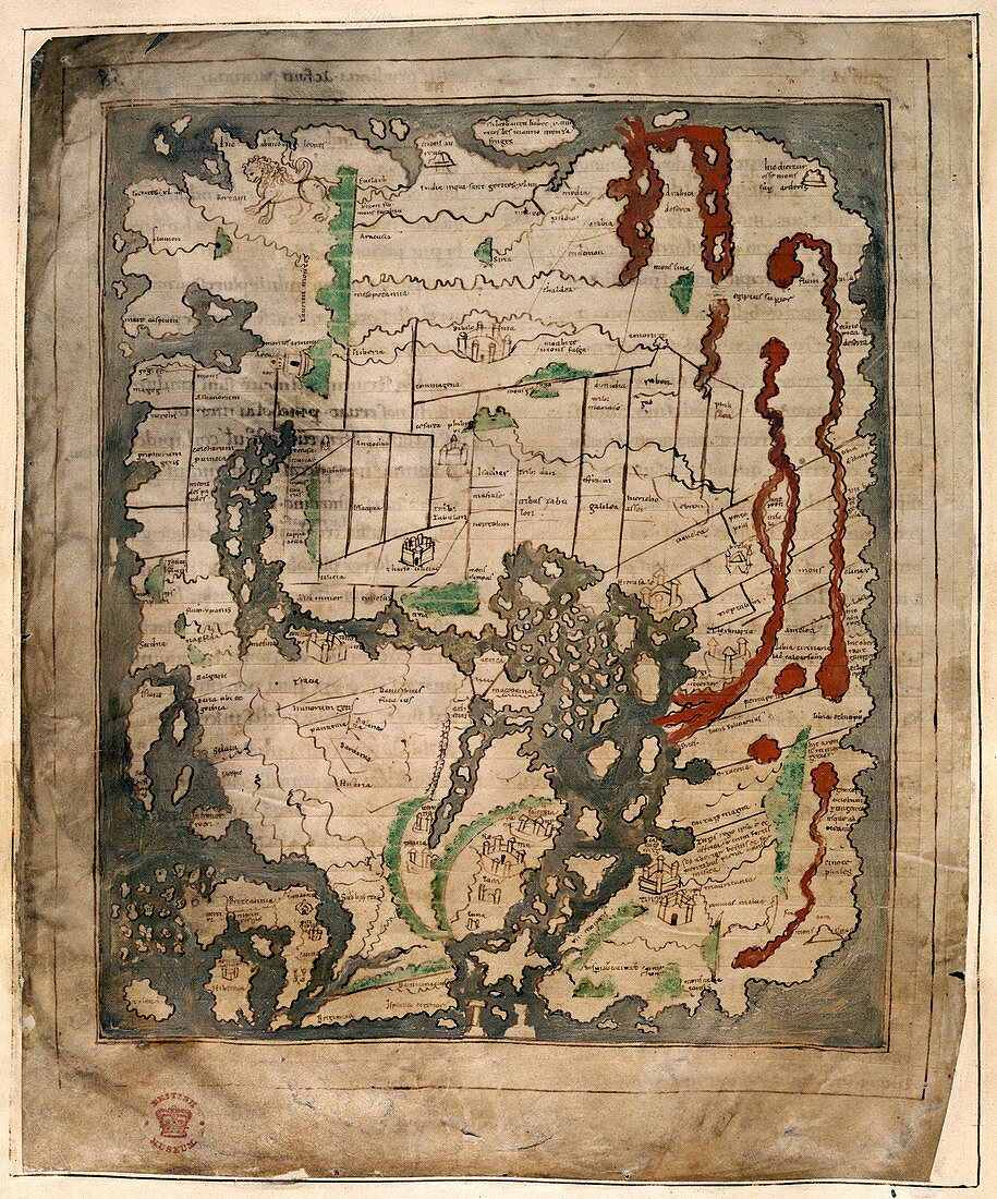
| Anglo-Saxon world map. This map is dated between 1025 and 1050. It shows the earliest known accurate depiction of the British Isles. East is at the top. It is divided into the three continents of Europe,Asia and Africa,with the Mediterranean Sea in the centre. The outline and detail of the British Isles are relatively accurate,with London and Winchester represented as town buildings,and the river Thames and another river indicated. In Ireland,there is the first representation of Armagh,and the Isle of Man,and the Orkney Islands can be identified. Cornwall is exaggerated,possibly to indicate its importance as a source of tin and copper | |
| Licence : | Droits gérés |
| Crédit: | Science Photo Library / British Library |
| Taille de l’image : | 3813 px × 4583 px |
| Model Release : | Non requis |
| Property Release : | Non requis |
| Restrictions : | - |
Prix pour cette image À partir de 45 €
Produit vendu
(Calendrier, Carte postale, Carte de vœux, Impression sur textile, Packaging etc)
À partir de 45 €
Usage commercial
(Affichage, Annonce presse, Annonce TV, Carte, Digital - hors rés. sociaux, Digital - rés. sociaux etc)
À partir de 45 €
Éditorial
(Digital, Journal, Livre, Livre pratique, Magazine, Télévision etc)
À partir de 60 €
Usage non-commercial
(Digital - hors rés. sociaux, Digital - rés. sociaux etc)
À partir de 120 €
Mots clés
- 1025,
- 11ème siècle,
- Afrique,
- âges moyens,
- Albion,
- Angleterre,
- anglo-saxon,
- antiquité,
- Asie,
- carte,
- carte du monde,
- cartes,
- cartographie,
- cartographique,
- classique,
- COTTONIANA,
- époque médiévale,
- Europe,
- européen,
- géographie,
- géographique,
- Grande Bretagne,
- Grande-Bretagne,
- histoire,
- historique,
- latin,
- mappa mundi,
- médiéval,
- médiévale,
- moyen âge,
- Royaume Uni,
- Royaume-Uni