Map of Great Britain and Ireland
Numéro d’image : 11673326
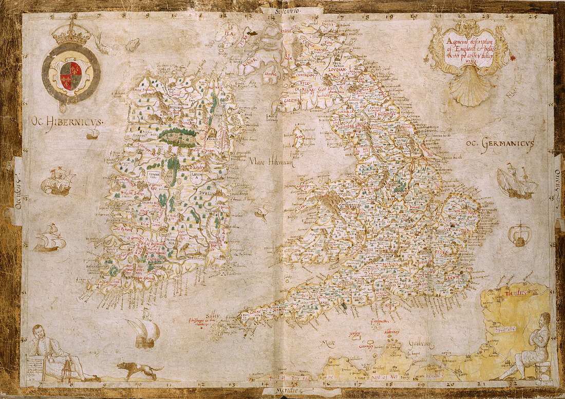
| Map of Great Britain and Ireland Whole map Map of England and Ireland extending from Arbroath in Scotland to the Franco-Flemish coaSt From a geographical commonplace book of William Cecil Lord Burghley with his annotations. In lower corners; a reclining figure Nowell? with dog and Cecil seated on an hour glass Image taken from Nowell-Burghley Atlas. Originally published in circa 1564. Illustrated by Laurence Nowell | |
| Licence : | Droits gérés |
| Crédit: | Science Photo Library / British Library |
| Taille de l’image : | 4975 px × 3513 px |
| Model Release : | Non requis |
| Property Release : | Non requis |
| Restrictions : | - |
Prix pour cette image À partir de 45 €
Produit vendu
(Calendrier, Carte postale, Carte de vœux, Impression sur textile, Packaging etc)
À partir de 45 €
Usage commercial
(Affichage, Annonce presse, Annonce TV, Carte, Digital - hors rés. sociaux, Digital - rés. sociaux etc)
À partir de 45 €
Éditorial
(Digital, Journal, Livre, Livre pratique, Magazine, Télévision etc)
À partir de 60 €
Usage non-commercial
(Digital - hors rés. sociaux, Digital - rés. sociaux etc)
À partir de 120 €