Chart of New Zealand
Numéro d’image : 11673289
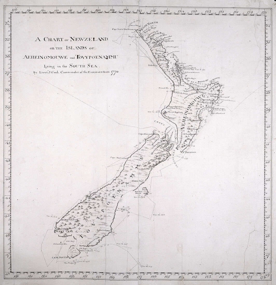
| A chart of New Zealand,or the islands of Aeheinomouwe and Tovypoenammu,lying in the South Sea. 1770 Image taken from Charts,Plans,Views,and Drawings taken on board the Endeavour during Captain Cook's First Voyage,1768-1771. Originally published in 1770. Illustrated by James Cook,Charles Praval | |
| Licence : | Droits gérés |
| Crédit: | Science Photo Library / British Library |
| Taille de l’image : | 4112 px × 4251 px |
| Model Release : | Non requis |
| Property Release : | Non requis |
| Restrictions : | - |
Prix pour cette image À partir de 45 €
Produit vendu
(Calendrier, Carte postale, Carte de vœux, Impression sur textile, Packaging etc)
À partir de 45 €
Usage commercial
(Affichage, Annonce presse, Annonce TV, Carte, Digital - hors rés. sociaux, Digital - rés. sociaux etc)
À partir de 45 €
Éditorial
(Digital, Journal, Livre, Livre pratique, Magazine, Télévision etc)
À partir de 60 €
Usage non-commercial
(Digital - hors rés. sociaux, Digital - rés. sociaux etc)
À partir de 120 €