Straits of Magellan
Numéro d’image : 11673285
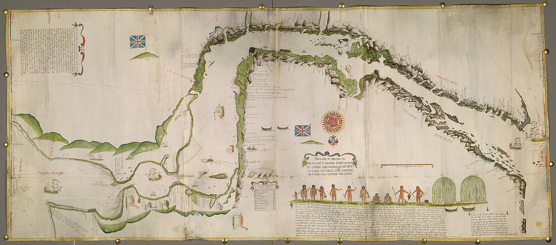
| Pictorial map of the Straits of Magellan. Image taken from The Land of Patagona,etc. The draught of Magellan Straits,drawen by Captain John Narbrough,anno 1670,on board His Majesti's Shipp Sweepstaks,as I pased and repased the Straits; being a large colored chart,drawn on vellum,on a scale of 4 miles to an inch.. Originally published in 1670 | |
| Licence : | Droits gérés |
| Crédit: | Science Photo Library / British Library |
| Taille de l’image : | 6288 px × 2779 px |
| Model Release : | Non requis |
| Property Release : | Non requis |
| Restrictions : | - |
Prix pour cette image À partir de 45 €
Produit vendu
(Calendrier, Carte postale, Carte de vœux, Impression sur textile, Packaging etc)
À partir de 45 €
Usage commercial
(Affichage, Annonce presse, Annonce TV, Carte, Digital - hors rés. sociaux, Digital - rés. sociaux etc)
À partir de 45 €
Éditorial
(Digital, Journal, Livre, Livre pratique, Magazine, Télévision etc)
À partir de 60 €
Usage non-commercial
(Digital - hors rés. sociaux, Digital - rés. sociaux etc)
À partir de 120 €