Map of King George's Island
Numéro d’image : 11665633
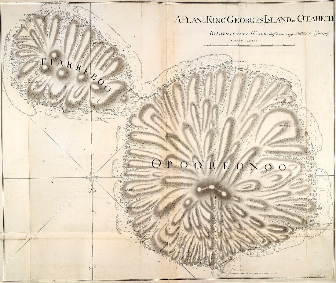
| Map of King George's Island,Whole map Map of King George's Island or Otaheite Tahiti. Journal of Captain Cook,26-28 June 1769 Image taken from Charts,Plans,Views and Drawings taken on board the Endeavour during Captain Cook's First Voyage,1768-1771. Originally published in Tahiti; 1769. Illustrated by Captain James Cook | |
| Licence : | Droits gérés |
| Crédit: | Science Photo Library / British Library |
| Taille de l’image : | 5121 px × 4320 px |
| Model Release : | Non requis |
| Property Release : | Non requis |
| Restrictions : | - |
Prix pour cette image À partir de 45 €
Produit vendu
(Calendrier, Carte postale, Carte de vœux, Impression sur textile, Packaging etc)
À partir de 45 €
Usage commercial
(Affichage, Annonce presse, Annonce TV, Carte, Digital - hors rés. sociaux, Digital - rés. sociaux etc)
À partir de 45 €
Éditorial
(Digital, Journal, Livre, Livre pratique, Magazine, Télévision etc)
À partir de 60 €
Usage non-commercial
(Digital - hors rés. sociaux, Digital - rés. sociaux etc)
À partir de 120 €
Mots clés
- anglais,
- archipel,
- aristocrates,
- aristocratie,
- Asie,
- bourgeoise,
- capitaine James Cook,
- carte,
- cartes,
- cartographie,
- chef,
- cuisine,
- cuisiner,
- diagrammes,
- faire la cuisine,
- fantassin,
- général,
- grade naval,
- graphiques,
- histoire,
- historique,
- île,
- îles,
- JAMES COOK,
- messieurs,
- occupations gouvernementales,
- occupations militaires,
- officier,
- officier de la marine,
- plans,
- rang naval,
- redevance,
- roi,
- royauté,
- soldat,
- tableaux