Surveying Instruments and Techniques
Numéro d’image : 11655234
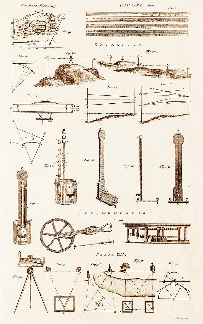
| Plate from 18th century encyclopedia showing illustrations of various surveying instruments and techniques. Shown are proceedures for compass surveying,triangulation,and leveling. Instruments shown include; gauging rod,sighting telescope,barometers,perambulator and plain tables. In levelling a typical procedure is to set up the instrument within 100 metres of a point of known or assumed elevation. A rod or staff is held vertical on that point and the instrument is used manually or automatically to read the rod scale. This gives the height of the instrument above the starting (backsight) point and allows the height of the instrument above the datum to be computed | |
| Licence : | Droits gérés |
| Crédit: | Science Photo Library / Parker, David |
| Taille de l’image : | 4445 px × 7106 px |
| Model Release : | Non requis |
| Property Release : | Non requis |
| Restrictions : | - |
Prix pour cette image À partir de 45 €
Produit vendu
(Calendrier, Carte postale, Carte de vœux, Impression sur textile, Packaging etc)
À partir de 45 €
Usage commercial
(Affichage, Annonce presse, Annonce TV, Carte, Digital - hors rés. sociaux, Digital - rés. sociaux etc)
À partir de 45 €
Éditorial
(Digital, Journal, Livre, Livre pratique, Magazine, Télévision etc)
À partir de 60 €
Usage non-commercial
(Digital - hors rés. sociaux, Digital - rés. sociaux etc)
À partir de 120 €