Albernaz's world map,1630
Numéro d’image : 11622216
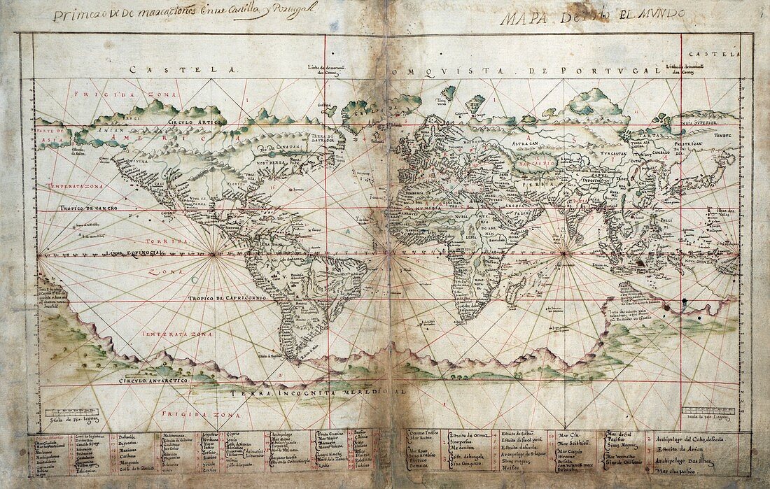
| Albernaz's world map. 1630 map of the world,from an atlas ('Taboas geraes de toda a navegacao') by 17th-century Portuguese cartographer Joao Teixeira Albernaz. The map shows known areas of the Americas and the Far East (both incomplete). The northern and western coast of Australia was being mapped at this time,but Antarctica had yet to be discovered. This map shows the world divided between Spain (Castela,or Castile) and Portugal (across top) along demarcation lines (red) decided by two treaties in 1494 and 1529. Also shown are coastal details,rhumb lines,mountains and rivers,and over 70 labels (key at bottom) | |
| Licence : | Droits gérés |
| Crédit: | Science Photo Library / Library of Congress |
| Taille de l’image : | 5258 px × 3343 px |
| Model Release : | Non requis |
| Property Release : | Non requis |
| Restrictions : | - |
Prix pour cette image À partir de 45 €
Produit vendu
(Calendrier, Carte postale, Carte de vœux, Impression sur textile, Packaging etc)
À partir de 45 €
Usage commercial
(Affichage, Annonce presse, Annonce TV, Carte, Digital - hors rés. sociaux, Digital - rés. sociaux etc)
À partir de 45 €
Éditorial
(Digital, Journal, Livre, Livre pratique, Magazine, Télévision etc)
À partir de 60 €
Usage non-commercial
(Digital - hors rés. sociaux, Digital - rés. sociaux etc)
À partir de 120 €
Mots clés
- 1600,
- 1630,
- 17ème siècle,
- Afrique,
- âge de la découverte,
- Amérique du Nord,
- Amérique du Sud,
- Asie,
- Australie,
- carte,
- cartographie,
- cartographique,
- continent,
- continental,
- continents,
- empire,
- empires,
- espagnol,
- Eurasie,
- Europe,
- européen,
- géographie,
- géographique,
- histoire,
- historique,
- illustration,
- lignes,
- monde,
- oeuvre,
- portugais,
- terre,
- territoire,
- territoires,
- XVIIème siècle