18th Century map of Australia
Numéro d’image : 11591822
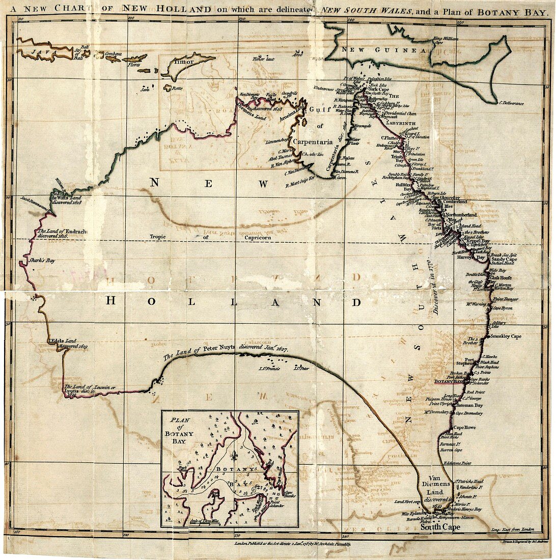
| 18th Century map of Australia. Historical map of Australia,which was known as New Holland at the time,showing settlements up the coast of New South Wales and an exploded plan of Botany Bay. Published by John Stockdale in 1787 | |
| Licence : | Droits gérés |
| Crédit: | Science Photo Library / Library of Congress |
| Taille de l’image : | 4401 px × 4433 px |
| Model Release : | Non requis |
| Property Release : | Non requis |
| Restrictions : | - |
Prix pour cette image À partir de 45 €
Produit vendu
(Calendrier, Carte postale, Carte de vœux, Impression sur textile, Packaging etc)
À partir de 45 €
Usage commercial
(Affichage, Annonce presse, Annonce TV, Carte, Digital - hors rés. sociaux, Digital - rés. sociaux etc)
À partir de 45 €
Éditorial
(Digital, Journal, Livre, Livre pratique, Magazine, Télévision etc)
À partir de 60 €
Usage non-commercial
(Digital - hors rés. sociaux, Digital - rés. sociaux etc)
À partir de 120 €