Martian landslides
Numéro d’image : 11591044
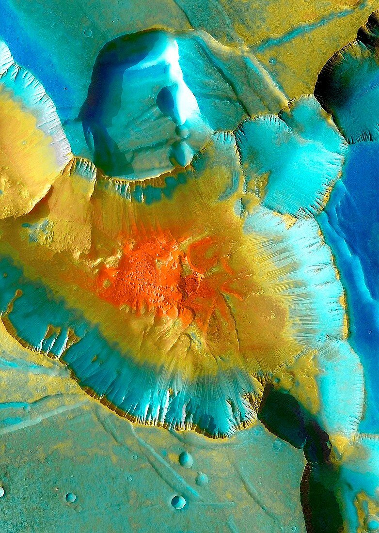
| Martian landslides. Coloured satellite image of landslides in the Noctis Labyrinthus on Mars. At the centre of this image is a 4 kilometre depression formed at the junction of a number of canyons. The red area shows larger debris from the landslide at the bottom of the depression. Image obtained by the Thermal Emission Imaging System (THEMIS) aboard NASA’s Mars Odyssey orbiter | |
| Licence : | Droits gérés |
| Crédit: | Science Photo Library / NASA |
| Taille de l’image : | 2133 px × 3000 px |
| Model Release : | Non requis |
| Property Release : | Non requis |
| Restrictions : | - |
Prix pour cette image À partir de 45 €
Produit vendu
(Calendrier, Carte postale, Carte de vœux, Impression sur textile, Packaging etc)
À partir de 45 €
Usage commercial
(Affichage, Annonce presse, Annonce TV, Carte, Digital - hors rés. sociaux, Digital - rés. sociaux etc)
À partir de 45 €
Éditorial
(Digital, Journal, Livre, Livre pratique, Magazine, Télévision etc)
À partir de 60 €
Usage non-commercial
(Digital - hors rés. sociaux, Digital - rés. sociaux etc)
À partir de 120 €