17th century sea chart
Numéro d’image : 11588019
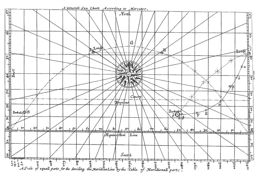
| 17th century sea chart for a voyage from Londy to Barbados. This shows the Rhumb line (following the same azimuth,right) and the Great Circle (shortest distance across a globe,left). Image from "Mariners Magazine" Samuel Sturmy (1669) | |
| Licence : | Droits gérés |
| Crédit: | Science Photo Library / Royal Astronomical Society |
| Taille de l’image : | 5067 px × 3531 px |
| Model Release : | Non requis |
| Property Release : | Non requis |
| Restrictions : | - |
Prix pour cette image À partir de 45 €
Produit vendu
(Calendrier, Carte postale, Carte de vœux, Impression sur textile, Packaging etc)
À partir de 45 €
Usage commercial
(Affichage, Annonce presse, Annonce TV, Carte, Digital - hors rés. sociaux, Digital - rés. sociaux etc)
À partir de 45 €
Éditorial
(Digital, Journal, Livre, Livre pratique, Magazine, Télévision etc)
À partir de 60 €
Usage non-commercial
(Digital - hors rés. sociaux, Digital - rés. sociaux etc)
À partir de 120 €