Flood monitor,UK
Numéro d’image : 11566698
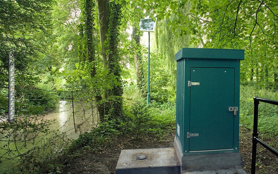
| Flood monitor. River water level gauge located by a tributary of the Upper Thames river. This device uses a telemetry system to measure the height of the stream and to automatically transmit the readings by landline to give flood warnings. It forms part of a network of similar stations and is powered by the pole-mounted solar panel in the background. The gaugeboard in the stream is registering a height above sea level of 84.4 metres. Photographed in England,UK | |
| Licence : | Droits gérés |
| Crédit: | Science Photo Library / Terry, Sheila |
| Taille de l’image : | 5467 px × 3425 px |
| Model Release : | Non requis |
| Property Release : | Non requis |
| Restrictions : | - |
Prix pour cette image À partir de 45 €
Produit vendu
(Calendrier, Carte postale, Carte de vœux, Impression sur textile, Packaging etc)
À partir de 45 €
Usage commercial
(Affichage, Annonce presse, Annonce TV, Carte, Digital - hors rés. sociaux, Digital - rés. sociaux etc)
À partir de 45 €
Éditorial
(Digital, Journal, Livre, Livre pratique, Magazine, Télévision etc)
À partir de 60 €
Usage non-commercial
(Digital - hors rés. sociaux, Digital - rés. sociaux etc)
À partir de 120 €
Mots clés
- à énergie solaire,
- affluent,
- alimentation solaire,
- anglais,
- Angleterre,
- appareil,
- avertissements,
- dispositif,
- eau,
- énergie solaire,
- équipement,
- Europe,
- européen,
- géographie,
- géographique,
- ingénierie,
- inondation,
- jauge,
- machine,
- manomètre,
- matériel,
- mesure,
- mesurer,
- mètre,
- monitoring,
- panneau solaire,
- réseau,
- rivière,
- Royaume Uni,
- Royaume-Uni,
- surveillance,
- système,
- technologie,
- technologique,
- télémétrie