Wilkins Ice Shelf on Antarctic Peninsula
Numéro d’image : 11554200
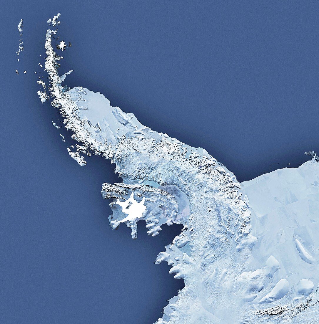
| Wilkins Ice Shelf. Satellite map showing the location of the Wilkins Ice Shelf (white) on the Antarctic Peninsula. The partial break-up of this massive ice shelf during February and March 2008 was observed by satellite imagery and using survey aircraft. An area of 405 square kilometres broke away,and as of 2009 the rest of the ice shelf (some 14,000 square kilometres) is attached to the land only by a narrow strip of ice. It is thought that global warming will eventually cause the entire ice shelf to be lost | |
| Licence : | Droits gérés |
| Crédit: | Science Photo Library / British Antarctic Survey |
| Taille de l’image : | 4200 px × 4258 px |
| Model Release : | Non requis |
| Property Release : | Non requis |
| Restrictions : | - |
Prix pour cette image À partir de 45 €
Produit vendu
(Calendrier, Carte postale, Carte de vœux, Impression sur textile, Packaging etc)
À partir de 45 €
Usage commercial
(Affichage, Annonce presse, Annonce TV, Carte, Digital - hors rés. sociaux, Digital - rés. sociaux etc)
À partir de 45 €
Éditorial
(Digital, Journal, Livre, Livre pratique, Magazine, Télévision etc)
À partir de 60 €
Usage non-commercial
(Digital - hors rés. sociaux, Digital - rés. sociaux etc)
À partir de 120 €
Mots clés
- 2008,
- 21ème siècle,
- Antarctique,
- Antartica,
- banquise,
- briser,
- carte,
- casser,
- changement climatique,
- climatologie,
- climatologique,
- de l'espace,
- désintégration,
- eau,
- éclatement,
- géographie,
- géographique,
- glace,
- glaciologie,
- image satellite,
- péninsule antartique,
- plateau de glace,
- réchauffement climatique,
- recherche,
- rompre,
- rupture,
- satellite,
- Sciences de la Terre,
- terre,
- XX1ème siècle