Images
Vidéos
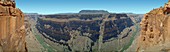
13417509 - Grand Canyon from Torroweap Overlook.
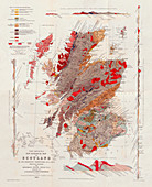
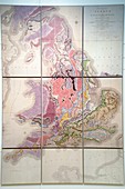
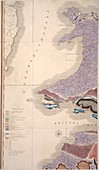
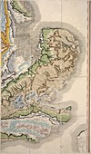
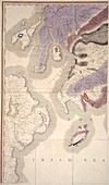
13297711 - Murchison's New Geological Map of Scotland, 1861
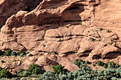
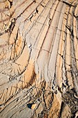
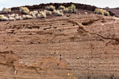
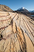
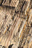
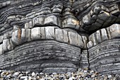
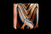
12654696 - Cross-bedded Sandstone at Canyon de Chelly
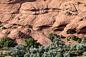
12654698 - Cross-bedded Sandstone at Canyon de Chelly
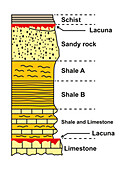
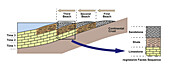
13743893 - Stratigraphic column, illustration
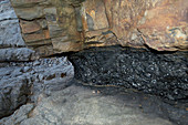
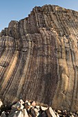
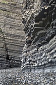
13387111 - Coal seam
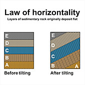
13958176 - Law of horizontality, illustration
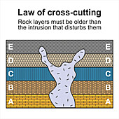
13958175 - Law of cross-cutting, illustration
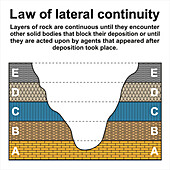
13958177 - Law of lateral continuity, illustration
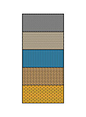
13743892 - Stratigraphic column, illustration
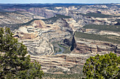
12654604 - Yampa River in Dinosaur National Monument
12491912 - Rock formation, Segelsallskarpet, Greenland

12653037 - Alexandre Brongniart, French Chemist
12654704 - Strata showing Volcanic Ash Deposition
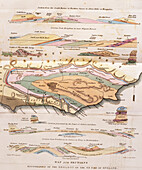
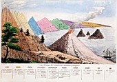
13476193 - The Age of the Weald, geological map and cross-section

12948551 - First geological map of Britain, 1824 edition
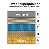
13958178 - Law of superposition, illustration
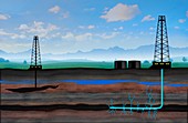
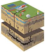
12650451 - Artwork Depicting Fracking
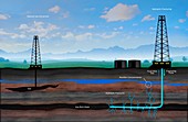
12652901 - Artwork Depicting Fracking
12491911 - Rock formation, Segelsallskarpet, Greenland

12491910 - Rock formation, Segelsallskarpet, Greenland
12491914 - Rock formation, Segelsallskarpet, Greenland
13743855 - Marine regression, illustration
12491915 - Rock formation, Segelsallskarpet, Greenland
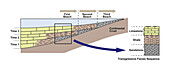
13743856 - Marine transgression, illustration

11717990 - Rock strata diagram,1838
12491916 - Rock formation, Segelsallskarpet, Greenland
12491913 - Rock formation, Segelsallskarpet, Greenland

12349345 - Gustav Arthur Cooper, US paleobiologist
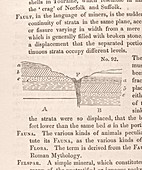
11716796 - Geological fault,diagram,1830
12056001 - First geological map of Britain,1815
11733936 - 1834 Section through Geological Strata

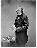
11702679 - Charles Lyell,British geologist
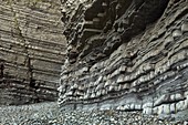
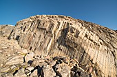
12098948 - Cliffs of Aberystwyth Grits,Wales
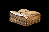
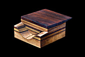
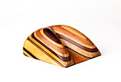
11694005 - Sopwith Model I: Stratified denuded rock
11694037 - Sopwith Model VII: Denuded mineral veins
11694032 - Sopwith Model VI: Mineral veins intersect
11694023 - Sopwith Model VIII: Overcutting of strata
12098952 - Cliffs of Aberystwyth Grits,Wales
11694044 - Sopwith Model IV: Surface coal indication

11694025 - Sopwith Model X: Denuded,inclined strata

11694014 - Sopwith Model V: Dislocation of strata

11694046 - Sopwith Model V: Dislocated coal strata
11694018 - Sopwith Model VII: Surface denudation
12098949 - Stratified marine sedimentary rocks
11694039 - Sopwith Model II: Coal strata
11694030 - Sopwith Model VI: Mineral veins intersect
11694089 - Sopwith Model XII: Denuded mineral veins

11694049 - Sopwith Model VII: Denuded mineral veins
11694016 - Sopwith Model X: Denuded inclined strata

11694007 - Sopwith Model II: Coal strata

11733618 - 1840 Christian Leopold Von Buch Portrait
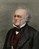
11732161 - Sir Charles Lyell,British geologist

11677138 - Coal seam
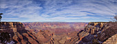
12047774 - South Rim of the Grand Canyon
11694057 - Sopwith Model VI: Mineral veins intersect
11694056 - Sopwith Model VI: Mineral veins intersect
11694020 - Sopwith Model VII: Surface denudation
11694013 - Sopwith Model V: Dislocation of strata
11694008 - Sopwith Model III: Dislocation of strata
11650757 - First geological map of Britain,1815
11694033 - Sopwith Model VI: Mineral veins intersect
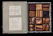
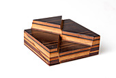
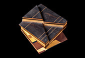
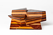
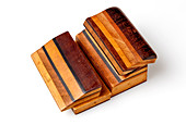
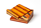
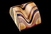
11694003 - Thomas Sopwith's Geological Model Set
11694040 - Sopwith Model I: Stratified,denuded rock

11733430 - 1834 Geology as a Hobby stratified rock
11694055 - Sopwith Model XI: Mineral veins intersect

11694052 - Sopwith Model VIII: Overcutting of strata
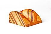
11694041 - Sopwith Model I: Stratified,denuded rock

12049786 - Panorama of Khone Falls
12042865 - Fracking,illustration
11694053 - Sopwith Model XII: Denuded mineral veins
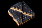
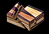
11694036 - Sopwith Models: denuded strata
11694010 - Sopwith Model III: Dislocation of strata
11694015 - Sopwith Model V: Dislocation of strata
11650756 - First geological map of Britain,1815
11694090 - Sopwith Model X: Denuded,inclined strata
11694048 - Sopwith Model VII: Denuded mineral veins
11694022 - Sopwith Model VIII: Overcutting of strata
12042647 - Fracking,illustration
11694059 - Thomas Sopwith geological models
11694019 - Sopwith Model VII: Surface denudation
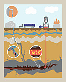
12042653 - Fracking,illustration
11694043 - Sopwith Model III: Dislocation of strata
11694026 - Sopwith Model X: Denuded,inclined strata
11650755 - First geological map of Britain,1815
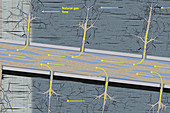
12042863 - Fracking,illustration
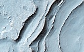
11716844 - Layering in Spallanzani Crater,Mars
11694011 - Sopwith Model IV: Coal seam outcrops
11694024 - Sopwith Model XII: Denuded mineral veins
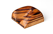
11694006 - Sopwith Model I: Stratified denuded rock
12042862 - Fracking,illustration

11694058 - Sopwith Model VI: Mineral veins intersect

11694045 - Sopwith Model IV: Surface coal indication
11694029 - Sopwith Model XI: Vertical intersection
11694027 - Sopwith Model X: Denuded,inclined strata
12042864 - Fracking,illustration
11694050 - Sopwith Model VII: Denuded mineral veins
11694035 - Sopwith Models: denuded strata
11595932 - Charles Lyell,British geologist
page suivante
Stratigraphie Photos ❘ Science Photo Library