Flooding in Eastern Australia, satellite image
Numéro d’image : 13736149
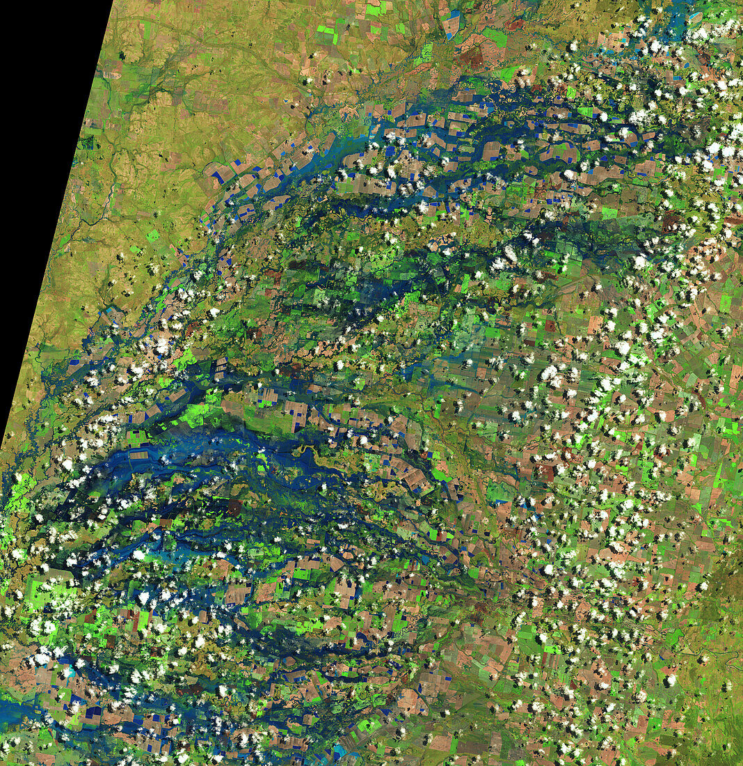
| Satellite image showing flooding in New South Wales and along the border in Queensland, Australia on the 29th of October 2022. The rivers and streams shown in the image are part of the Murray-Darling basin, which saw its wettest October on record in 2022. Image obtained by the by Visible Infrared Imaging Radiometer Suite (VIIRS) instruments on the Suomi NPP satellite. | |
| Licence : | Droits gérés |
| Crédit: | Science Photo Library / NASA |
| Taille de l’image : | 5219 px × 5375 px |
| Model Release : | Non requis |
| Property Release : | Non requis |
| Restrictions : | - |
Prix pour cette image À partir de 45 €
Produit vendu
(Calendrier, Carte postale, Carte de vœux, Impression sur textile, Packaging etc)
À partir de 45 €
Usage commercial
(Affichage, Annonce presse, Annonce TV, Carte, Digital - hors rés. sociaux, Digital - rés. sociaux etc)
À partir de 45 €
Éditorial
(Digital, Journal, Livre, Livre pratique, Magazine, Télévision etc)
À partir de 60 €
Usage non-commercial
(Digital - hors rés. sociaux, Digital - rés. sociaux etc)
À partir de 120 €
Mots clés
- aucun,
- australien,
- averse,
- chute de pluie,
- crue,
- d'en haut,
- de l'espace,
- du haut,
- eaux fluviales,
- environnement,
- environnemental,
- géographie,
- géographique,
- image satellite,
- inondation,
- instrument VIIRS,
- New South Wales,
- Nouvelle Galle du Sud,
- Nouvelle Galles du Sud,
- personne,
- plongeant,
- précipitation,
- Queensland,
- rivière,
- Suomi NPP,
- VIIRS,
- Visible Infrared Imaging Radiometer Suite