Agriculture around Lake Nasser, Egypt, satellite image
Numéro d’image : 13672021
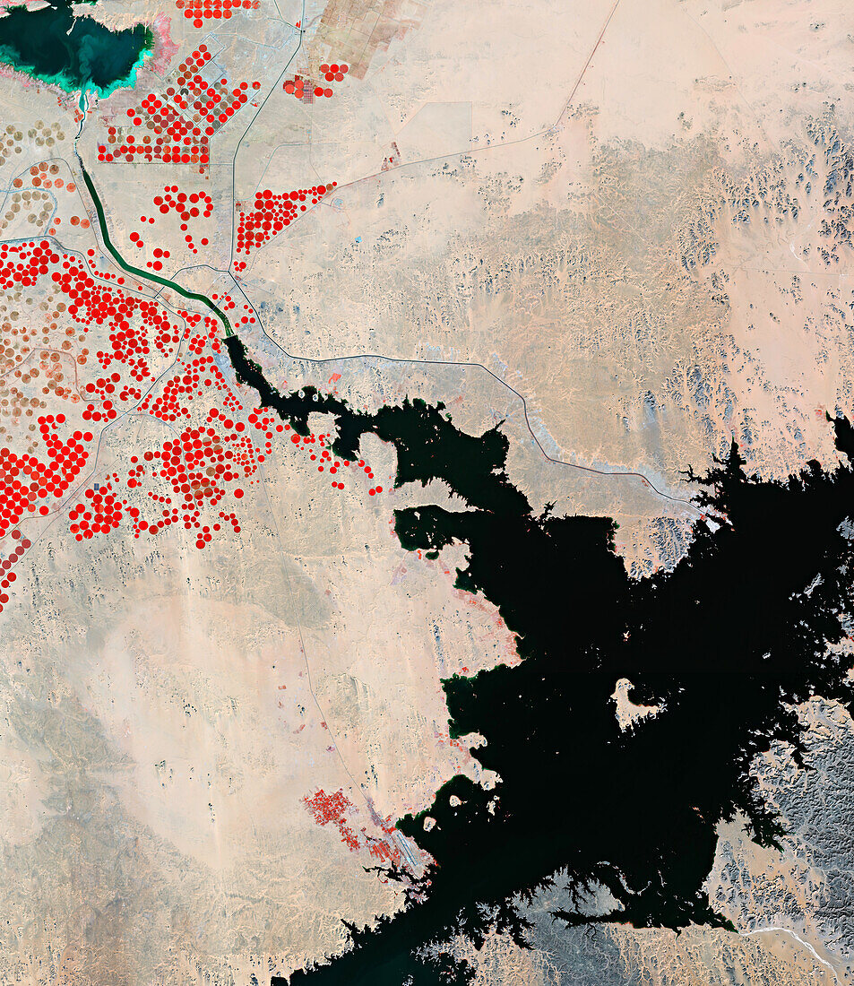
| Composite infrared satellite image of Lake Nasser (bottom right), Egypt, and surrounding agricultural land. Vegetation is red. The red circular areas are pivot irrigation fields. Lake Nasser is a large lake, measuring 550 kilometres long, formed as a result of the Aswan High Dam across the River Nile. Data obtained by the Copernicus Sentinel-2 satellite. | |
| Licence : | Droits gérés |
| Crédit: | Science Photo Library / ESA |
| Taille de l’image : | 7334 px × 8468 px |
| Model Release : | Non requis |
| Property Release : | Non requis |
| Restrictions : |
|
Prix pour cette image À partir de 45 €
Produit vendu
(Calendrier, Carte postale, Carte de vœux, Impression sur textile, Packaging etc)
À partir de 45 €
Usage commercial
(Affichage, Annonce presse, Annonce TV, Carte, Digital - hors rés. sociaux, Digital - rés. sociaux etc)
À partir de 45 €
Éditorial
(Digital, Journal, Livre, Livre pratique, Magazine, Télévision etc)
À partir de 60 €
Usage non-commercial
(Digital - hors rés. sociaux, Digital - rés. sociaux etc)
À partir de 120 €
Mots clés
- ABU SIMBEL,
- aéroport,
- africain,
- Afrique du Nord,
- agricole,
- agriculture,
- aucun,
- canal,
- champ,
- champs,
- circulaire,
- colorisé,
- composite,
- Copernic,
- damné,
- de l'espace,
- défilé,
- eau,
- Égypte,
- endigué,
- fait un barrage,
- image satellite,
- infrarouge,
- irrigation,
- lac,
- personne,
- piste,
- pivot,
- réservoir,
- végétation