French earthquake, 2019, interferogram
Numéro d’image : 13671984
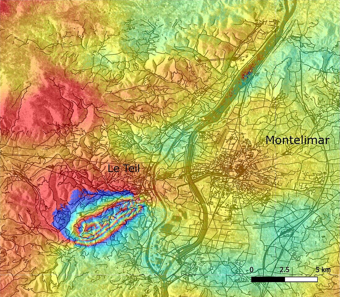
| Interferogram showing the fault, to the west of the city of Le Teil, that was responsible for the magnitude 5 earthquake in the south of France on the 11th November 2019. The interferogram is a comparison of data from the Copernicus Sentinel-1 satellite taken on the 6th and 12th November 2019 that shows changes in topography and ground movements. | |
| Licence : | Droits gérés |
| Crédit: | Science Photo Library / ESA |
| Taille de l’image : | 2470 px × 2161 px |
| Model Release : | Non requis |
| Property Release : | Non requis |
| Restrictions : |
|
Prix pour cette image À partir de 45 €
Produit vendu
(Calendrier, Carte postale, Carte de vœux, Impression sur textile, Packaging etc)
À partir de 45 €
Usage commercial
(Affichage, Annonce presse, Annonce TV, Carte, Digital - hors rés. sociaux, Digital - rés. sociaux etc)
À partir de 45 €
Éditorial
(Digital, Journal, Livre, Livre pratique, Magazine, Télévision etc)
À partir de 60 €
Usage non-commercial
(Digital - hors rés. sociaux, Digital - rés. sociaux etc)
À partir de 120 €
Mots clés
- 2000,
- 2010,
- 21ème siècle,
- aucun,
- carte,
- comparaison,
- de l'espace,
- défaillance,
- défaut,
- Europe,
- européen,
- faute,
- français,
- France,
- géologie,
- géologique,
- modèle d'interférence,
- mouvement,
- observation de la terre,
- personne,
- satellite,
- séisme,
- sismologie,
- sismologique,
- sol,
- Sud,
- surface,
- topographie,
- tremblement,
- tremblement de terre,
- XX1ème siècle