Hunga Tonga-Hunga Ha'apai volcanic island, satellite image
Numéro d’image : 13525029
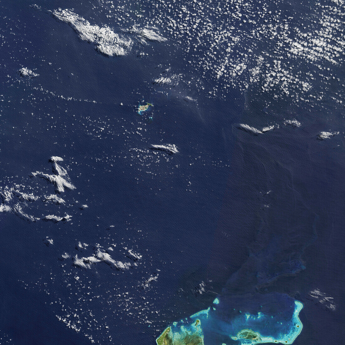
| Satellite image of Hunga Tonga-Hunga Ha'apai volcanic island (upper centre), Tonga. The island was formed by an eruption of the submarine volcano in December 2015. On the 14th January 2022 the volcano erupted again. The massive eruption caused a tsunami that spread rapidly across the Pacific Ocean and an atmospheric shock wave that was detected worldwide. Flooding from the tsunami and ash from the volcano caused destruction and loss of life on neighbouring islands. Much of the Hunga Tonga-Hunga Ha'apai volcanic island disappeared under water. Image data obtained on 11th December 2017 by the Operational Land Imager (OLI) on Landsat 8. | |
| Licence : | Droits gérés |
| Crédit: | Science Photo Library / U.S. Geological Survey / NASA Earth Observatory, Jesse Allen |
| Taille de l’image : | 5920 px × 5920 px |
| Model Release : | Non requis |
| Property Release : | Non requis |
| Restrictions : | - |
Prix pour cette image À partir de 45 €
Produit vendu
(Calendrier, Carte postale, Carte de vœux, Impression sur textile, Packaging etc)
À partir de 45 €
Usage commercial
(Affichage, Annonce presse, Annonce TV, Carte, Digital - hors rés. sociaux, Digital - rés. sociaux etc)
À partir de 45 €
Éditorial
(Digital, Journal, Livre, Livre pratique, Magazine, Télévision etc)
À partir de 60 €
Usage non-commercial
(Digital - hors rés. sociaux, Digital - rés. sociaux etc)
À partir de 120 €
Mots clés
- 2000,
- 21ème siècle,
- archipel,
- aucun,
- de l'espace,
- déserte,
- géologie,
- géologique,
- huiles,
- île,
- image satellite,
- imageur terrestre opérationnel,
- inhabité,
- landsat 8,
- landsat huit,
- LDCM,
- observation de la terre,
- Océan Pacifique,
- OLI,
- Operational Land Imager,
- personne,
- sous-marin,
- Tonga,
- tongane,
- volcan,
- volcanique,
- vulcanologie,
- XX1ème siècle