Atmospheric river, January 2016
Numéro d’image : 13523641
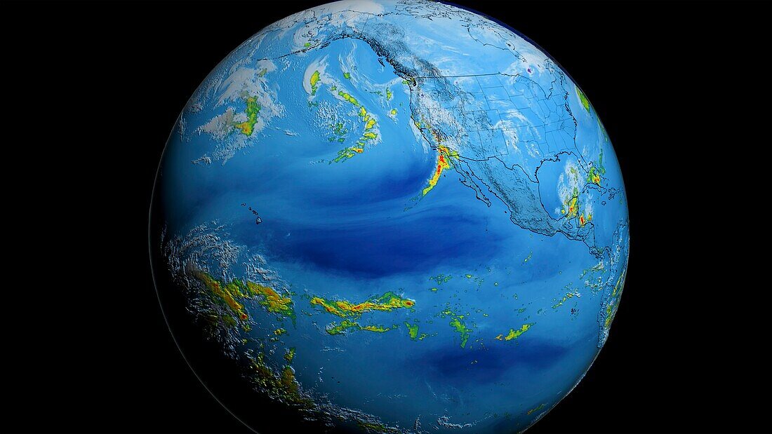
| Still image from an animation showing atmospheric river on the 5th of January 2016. Atmospheric rivers are long, narrow jets of air that can carry large amounts of water vapour from the tropics to the Earth's continents and polar regions. Atmospheric river is a good indicator of El Nino, the warm phase of the El Nino/La Nina-Southern Oscillation (ENSO) that occurs across the tropical Pacific Ocean roughly every five years. To show the activities of atmospheric river, the animation uses precipitation, water vapor and cloud data. The precipitation data is collected from IMERG, shown as green-red for liquid precipitation and blue-purple for frozen precipitation. Water vapour data from MERRA 2 is shown in blue and cloud data from GOES 15 is shown in white. | |
| Licence : | Droits gérés |
| Crédit: | Science Photo Library / NASA's Scientific Visualization Studio / NASA |
| Taille de l’image : | 4386 px × 2467 px |
| Model Release : | Non requis |
| Property Release : | Non requis |
| Restrictions : | - |
Prix pour cette image À partir de 45 €
Produit vendu
(Calendrier, Carte postale, Carte de vœux, Impression sur textile, Packaging etc)
À partir de 45 €
Usage commercial
(Affichage, Annonce presse, Annonce TV, Carte, Digital - hors rés. sociaux, Digital - rés. sociaux etc)
À partir de 45 €
Éditorial
(Digital, Journal, Livre, Livre pratique, Magazine, Télévision etc)
À partir de 60 €
Usage non-commercial
(Digital - hors rés. sociaux, Digital - rés. sociaux etc)
À partir de 120 €