General world map by Euler, 1753
Numéro d’image : 13435899
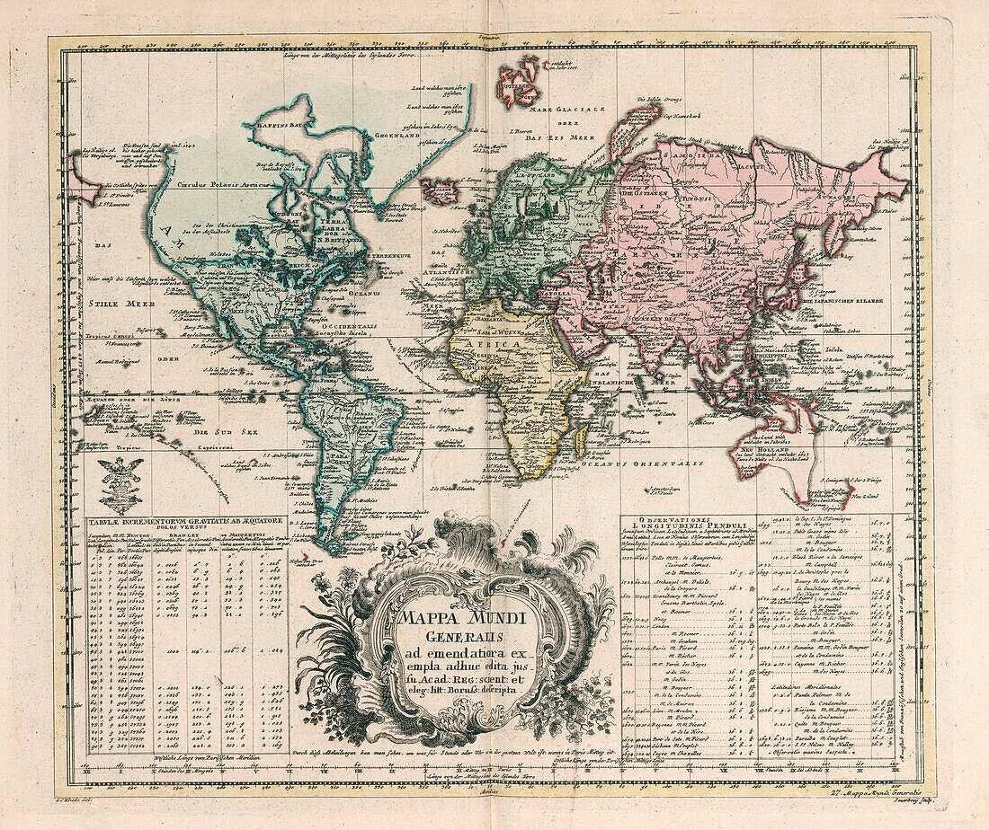
| General world map (Mappa Mundi generalis) by Leonhard Euler (1707-1783). Published in 1753 by Ex officina Michaelis, Berolini. Hand coloured copperplate engraving map on 2 sheets. The map shows North America, but the Northwest coast is blank and a river provides passage between the Great Lakes and the Pacific. Australia and New Zealand are depicted with partially completed coastlines. Relief shown pictorially. Prime meridian is Ferro. Includes two large explanation tables. | |
| Licence : | Droits gérés |
| Crédit: | Science Photo Library / Photostock-Israel |
| Taille de l’image : | 6000 px × 5042 px |
| Model Release : | Non requis |
| Property Release : | Non requis |
| Restrictions : | - |
Prix pour cette image À partir de 45 €
Produit vendu
(Calendrier, Carte postale, Carte de vœux, Impression sur textile, Packaging etc)
À partir de 45 €
Usage commercial
(Affichage, Annonce presse, Annonce TV, Carte, Digital - hors rés. sociaux, Digital - rés. sociaux etc)
À partir de 45 €
Éditorial
(Digital, Journal, Livre, Livre pratique, Magazine, Télévision etc)
À partir de 60 €
Usage non-commercial
(Digital - hors rés. sociaux, Digital - rés. sociaux etc)
À partir de 120 €
Mots clés
- 1700,
- 1753,
- 18ème siècle,
- Afrique,
- Amérique du Nord,
- Asie,
- aucun,
- Australie,
- carte,
- carte du monde,
- cartes,
- cartographie,
- cartographique,
- coloré à la main,
- colorée à la main,
- Euler,
- Europe,
- général,
- géographie,
- géographique,
- graver,
- gravure,
- histoire,
- historique,
- illustration,
- illustré,
- mappa mundi,
- monde,
- Nouvelle Zélande,
- Nouvelle-Zélande,
- oeuvre,
- personne,
- pictural,
- plaque de cuivre,
- terre,
- vieux,
- XVIIIème siècle