Cape Hatteras National Seashore, USA, satellite image
Numéro d’image : 13417423
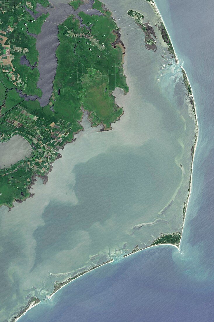
| Satellite image of Cape Hatteras National Seashore, USA. This national park preserves barrier islands that form a part of North Carolina's Outer Banks. The Outer Banks are simultaneously undergoing erosion and build-up of sand in other areas. At Cape Hatteras (right, pointed tip) the height and distance of sand dunes from the ocean has allowed forests to grow. The islands are exposed to hurricanes and nor'easters from the Atlantic Ocean. Image obtained by the Operational Land Imager (OLI) on the Landsat 8 satellite. | |
| Licence : | Droits gérés |
| Crédit: | Science Photo Library / NASA |
| Taille de l’image : | 4784 px × 7176 px |
| Model Release : | Non requis |
| Property Release : | Non requis |
| Restrictions : | - |
Prix pour cette image À partir de 45 €
Produit vendu
(Calendrier, Carte postale, Carte de vœux, Impression sur textile, Packaging etc)
À partir de 45 €
Usage commercial
(Affichage, Annonce presse, Annonce TV, Carte, Digital - hors rés. sociaux, Digital - rés. sociaux etc)
À partir de 45 €
Éditorial
(Digital, Journal, Livre, Livre pratique, Magazine, Télévision etc)
À partir de 60 €
Usage non-commercial
(Digital - hors rés. sociaux, Digital - rés. sociaux etc)
À partir de 120 €