Antarctic ice melt due to heat wave, satellite image
Numéro d’image : 13416748
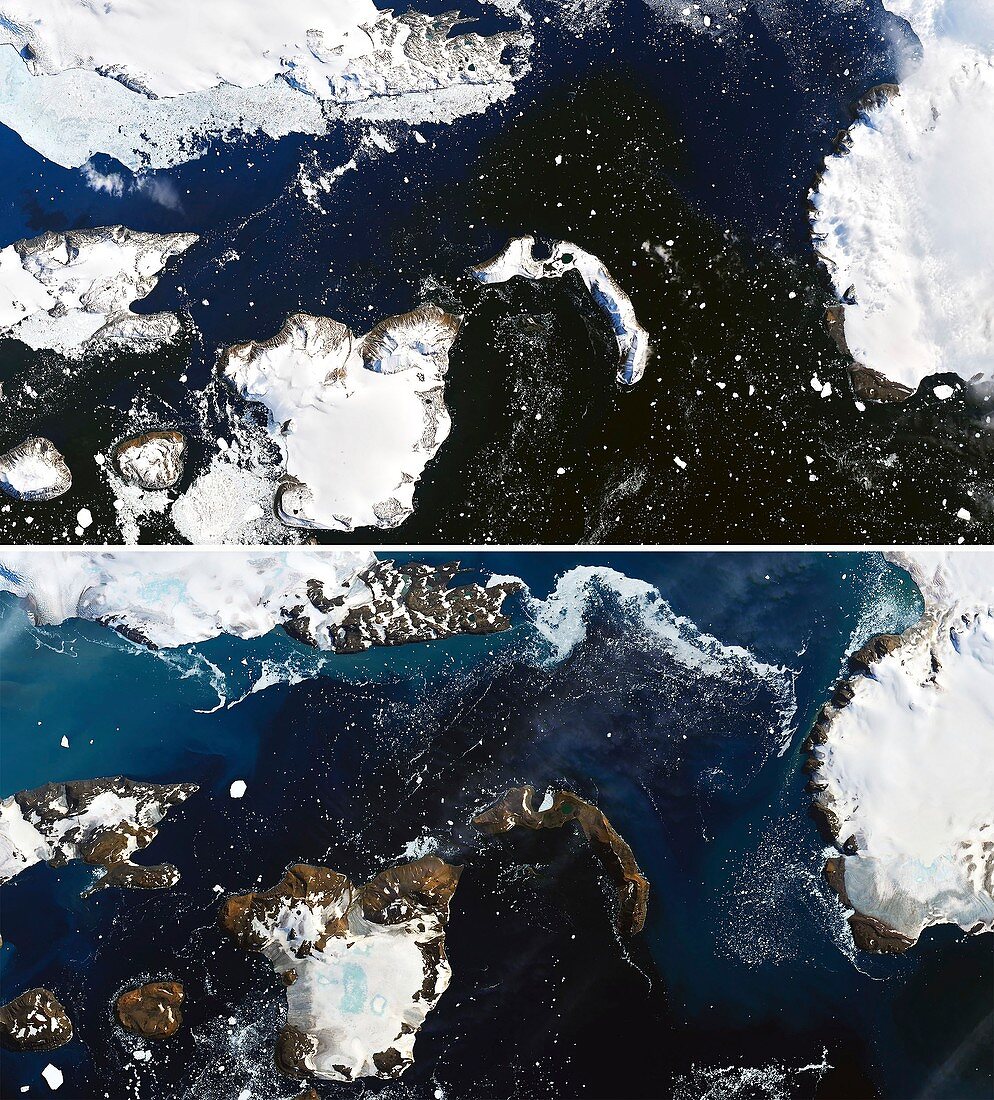
| Satellite image showing ice melt on Eagle Island, Antarctica, due to a heat wave the occurred between the 5th and 13th February 2020. The heat wave included the hottest temperature ever recorded in Antarctica, 18.3 degrees Celsius, on the 6th February. The top image was taken on the 4th February 2020, the bottom image on the 13th February. There is significantly less ice in the lower image and melt ponds (blue) can be seen on some of the ice caps. Image obtained by the Operational Land Imager (OLI) on the Landsat 8 satellite. | |
| Licence : | Droits gérés |
| Crédit: | Science Photo Library / NASA GSFC / GEOS-5 data / Landsat data from the USGS / Joshua Stevens |
| Taille de l’image : | 3082 px × 3412 px |
| Model Release : | Non requis |
| Property Release : | Non requis |
| Restrictions : | - |
Prix pour cette image À partir de 45 €
Produit vendu
(Calendrier, Carte postale, Carte de vœux, Impression sur textile, Packaging etc)
À partir de 45 €
Usage commercial
(Affichage, Annonce presse, Annonce TV, Carte, Digital - hors rés. sociaux, Digital - rés. sociaux etc)
À partir de 45 €
Éditorial
(Digital, Journal, Livre, Livre pratique, Magazine, Télévision etc)
À partir de 60 €
Usage non-commercial
(Digital - hors rés. sociaux, Digital - rés. sociaux etc)
À partir de 120 €
Mots clés
- 2000,
- 2020,
- 21ème siècle,
- Antarctique,
- Antartica,
- aucun,
- changement climatique,
- climat,
- de l'espace,
- faire fondre,
- fondre,
- fusion,
- géographie,
- géographique,
- glace,
- huiles,
- image satellite,
- imageur terrestre opérationnel,
- landsat 8,
- landsat huit,
- LDCM,
- observation de la terre,
- OLI,
- Operational Land Imager,
- personne,
- réchauffement climatique,
- vague de chaleur,
- XX1ème siècle