Northern hemisphere of Mercury, radar image
Numéro d’image : 13406616
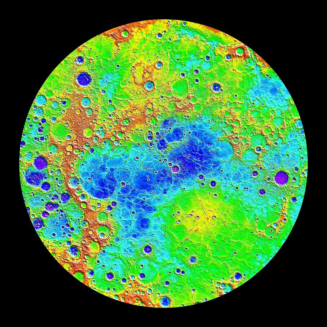
| Radar image of the northern hemisphere of Mercury generated with data from the Mercury Laser Altimeter (MLA) aboard NASA's MESSENGER spacecraft. The lowest regions are purple and the highest regions are red. The difference in elevation between the lowest and highest regions shown is roughly 10 kilometres. Among the prominent features visible here are the smooth northern volcanic plains and the northern rise. The low-lying craters near the north pole host radar-bright materials, thought to be water ice. The MLA measures the return time of transmitted laser pulses reflected from the surface of the planet and gives a high-precision measurement of surface topography referenced to MercuryÂ's centre of mass. | |
| Licence : | Droits gérés |
| Crédit: | Science Photo Library / Carnegie Institution of Washington / Johns Hopkins University Applied Physics Laboratory / NASA |
| Taille de l’image : | 4228 px × 4228 px |
| Model Release : | Non requis |
| Property Release : | Non requis |
| Restrictions : | - |
Prix pour cette image À partir de 45 €
Produit vendu
(Calendrier, Carte postale, Carte de vœux, Impression sur textile, Packaging etc)
À partir de 45 €
Usage commercial
(Affichage, Annonce presse, Annonce TV, Carte, Digital - hors rés. sociaux, Digital - rés. sociaux etc)
À partir de 45 €
Éditorial
(Digital, Journal, Livre, Livre pratique, Magazine, Télévision etc)
À partir de 60 €
Usage non-commercial
(Digital - hors rés. sociaux, Digital - rés. sociaux etc)
À partir de 120 €