Map of the Eastern Mediterranean, 1590
Numéro d’image : 13406155
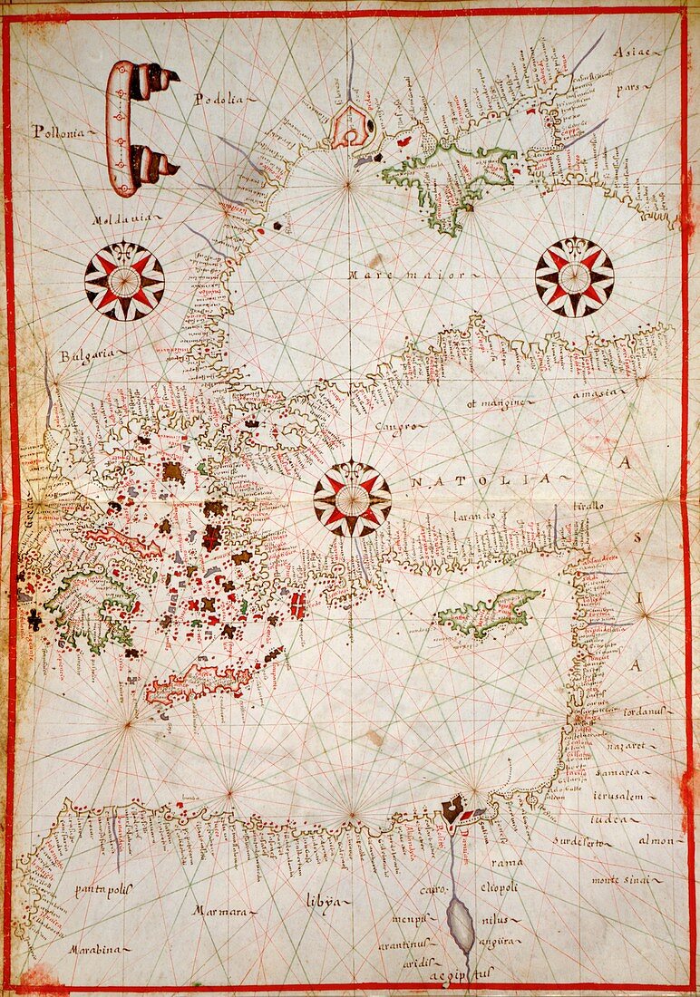
| 16th century map of the Eastern Mediterranean. Published around 1590, this map shows the coasts of the Eastern Mediterranean (lower frame) and the Black Sea (upper right), and forms part of a portolan atlas (a collection of navigational charts) by the cartographer Joan Oliva, who was active from 1580-1615. Several compass roses and artworks of sailing ships adorn the oceans, while the coasts are heavily annotated with the names of rivers, ports and bays. The lines on the map are rhumb lines, designed to make it easier to steer a straight course. Although the coastlines are distorted, maps like this were among the best available at the time. | |
| Licence : | Droits gérés |
| Crédit: | Science Photo Library / LIBRARY OF CONGRESS, GEOGRAPHY AND MAP DIVISION |
| Taille de l’image : | 3520 px × 5013 px |
| Model Release : | Non requis |
| Property Release : | Non requis |
| Restrictions : | - |
Prix pour cette image À partir de 45 €
Produit vendu
(Calendrier, Carte postale, Carte de vœux, Impression sur textile, Packaging etc)
À partir de 45 €
Usage commercial
(Affichage, Annonce presse, Annonce TV, Carte, Digital - hors rés. sociaux, Digital - rés. sociaux etc)
À partir de 45 €
Éditorial
(Digital, Journal, Livre, Livre pratique, Magazine, Télévision etc)
À partir de 60 €
Usage non-commercial
(Digital - hors rés. sociaux, Digital - rés. sociaux etc)
À partir de 120 €
Mots clés
- 1500,
- 1590,
- 16ème siècle,
- africain,
- Afrique du Nord,
- âge de la découverte,
- âges moyens,
- carte,
- cartes,
- cartographie,
- Chypre,
- côte,
- Crète,
- diagrammes,
- époque médiévale,
- Europe,
- européen,
- exploration,
- géographie,
- géographique,
- graphiques,
- histoire,
- historique,
- île,
- îles,
- maritime,
- médiéval,
- méditérranéen,
- mer,
- Mer Noire,
- moyen âge,
- Moyen Orient,
- Moyen-Orient,
- océan,
- oriental,
- orientale,
- tableaux,
- terre,
- vieux,
- XVIème siècle