Niepolomice Forest, Poland, satellite image
Numéro d’image : 13403702
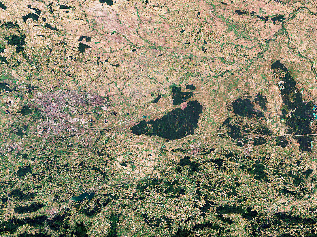
| Satellite image of the Niepolomice forest in Poland. The forest (dark green, centre) is surrounded by towns and farms and contains pockets of an old-growth deciduous forest that once covered the region. It is managed in small areas with different management strategies. These divisions are visible in the image, with sections of the forest that are a solid, untouched green, while others contain paler green clearings. Data obtained by the Operational Land Imager (OLI) on the NASA's Landsat 8 satellite. | |
| Licence : | Droits gérés |
| Crédit: | Science Photo Library / US Geological Survey / NASA Earth Observatory, Robert Simmon |
| Taille de l’image : | 5179 px × 3886 px |
| Model Release : | Non requis |
| Property Release : | Non requis |
| Restrictions : | - |
Prix pour cette image À partir de 45 €
Produit vendu
(Calendrier, Carte postale, Carte de vœux, Impression sur textile, Packaging etc)
À partir de 45 €
Usage commercial
(Affichage, Annonce presse, Annonce TV, Carte, Digital - hors rés. sociaux, Digital - rés. sociaux etc)
À partir de 45 €
Éditorial
(Digital, Journal, Livre, Livre pratique, Magazine, Télévision etc)
À partir de 60 €
Usage non-commercial
(Digital - hors rés. sociaux, Digital - rés. sociaux etc)
À partir de 120 €