Iceberg calved from Pine Island Glacier, Antarctica
Numéro d’image : 13258754
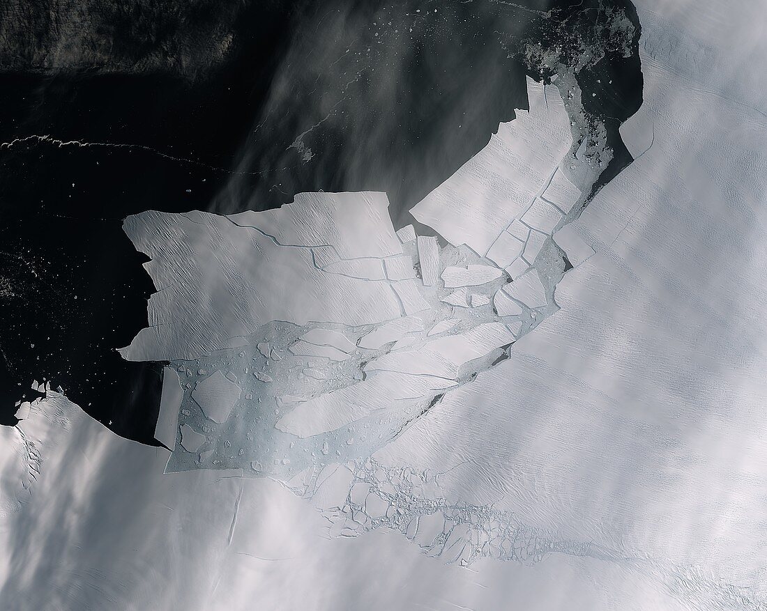
| Satellite image of a large glacier that shattered after calving from the Pine Island Glacier, Antarctica. The iceberg measured over 300 square kilometres. Pine Island Glacier is a type known as an ice stream, draining ice from the West Antarctic Ice Sheet into the ocean. If the glaciers in Antarctica disintegrate and melt, global sea levels would rise. Image obtained on 11th February 2020 by the Sentinel-2 satellite. | |
| Licence : | Droits gérés |
| Crédit: | Science Photo Library / EUROPEAN SPACE AGENCY / Copernicus Sentinel data (2020) |
| Taille de l’image : | 5321 px × 4242 px |
| Model Release : | Non requis |
| Property Release : | Non requis |
| Restrictions : |
|
Prix pour cette image À partir de 45 €
Produit vendu
(Calendrier, Carte postale, Carte de vœux, Impression sur textile, Packaging etc)
À partir de 45 €
Usage commercial
(Affichage, Annonce presse, Annonce TV, Carte, Digital - hors rés. sociaux, Digital - rés. sociaux etc)
À partir de 45 €
Éditorial
(Digital, Journal, Livre, Livre pratique, Magazine, Télévision etc)
À partir de 60 €
Usage non-commercial
(Digital - hors rés. sociaux, Digital - rés. sociaux etc)
À partir de 120 €
Mots clés
- 2000,
- 21ème siècle,
- Antarctique,
- Antartica,
- aucun,
- brisé,
- cassé,
- changement climatique,
- climatologie,
- climatologique,
- congelé,
- couvert de glace,
- couverture de glace,
- de l'espace,
- détruit,
- gelé,
- glace,
- glacé,
- glacial,
- glaciologie,
- iceberg,
- mettre bras,
- morceaux,
- observation de la terre,
- personne,
- pièces,
- réchauffement climatique,
- satellite,
- science de la terre,
- surgelé,
- verglacé,
- XX1ème siècle