Prehistoric Doggerland region, illustration
Numéro d’image : 12971797
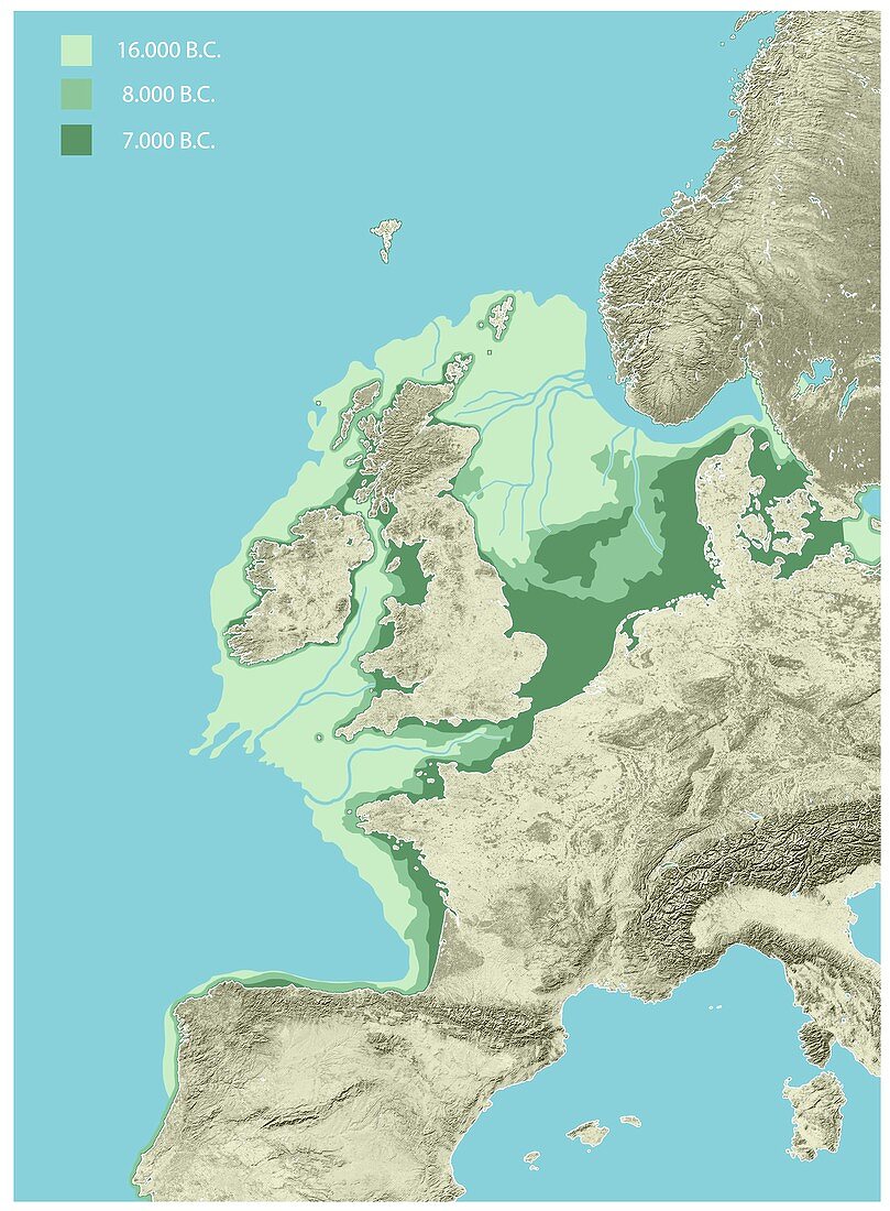
| Prehistoric Doggerland region, illustration. Doggerland was an area of land that existed thousands of years ago when sea levels were lower. Part of the continental shelf of north-western Europe, it connected the British Isles to mainland Europe in what is now the North Sea. It was flooded by rising sea levels between 18, 000 and 9000 years ago, shown here as colour-coded green areas. The key at top left gives the period when the land was above sea level: 16, 000 BC (light green), 8000 BC (green), and 7000 BC (dark green). Rivers flowed across Doggerland, and it was an important land bridge that allowed early humans and animals to cross between what is now the British Isles and mainland Europe. Doggerland would have been inhabited during the Mesolithic (Middle Stone Age). | |
| Licence : | Droits gérés |
| Crédit: | Science Photo Library / Lunau, Claus |
| Taille de l’image : | 3584 px × 4872 px |
| Model Release : | Non requis |
| Property Release : | Non requis |
| Restrictions : | - |
Prix pour cette image À partir de 45 €
Produit vendu
(Calendrier, Carte postale, Carte de vœux, Impression sur textile, Packaging etc)
À partir de 45 €
Usage commercial
(Affichage, Annonce presse, Annonce TV, Carte, Digital - hors rés. sociaux, Digital - rés. sociaux etc)
À partir de 45 €
Éditorial
(Digital, Journal, Livre, Livre pratique, Magazine, Télévision etc)
À partir de 60 €
Usage non-commercial
(Digital - hors rés. sociaux, Digital - rés. sociaux etc)
À partir de 120 €