Map of Guangdong and Hainan in China,17th century
Numéro d’image : 12960024
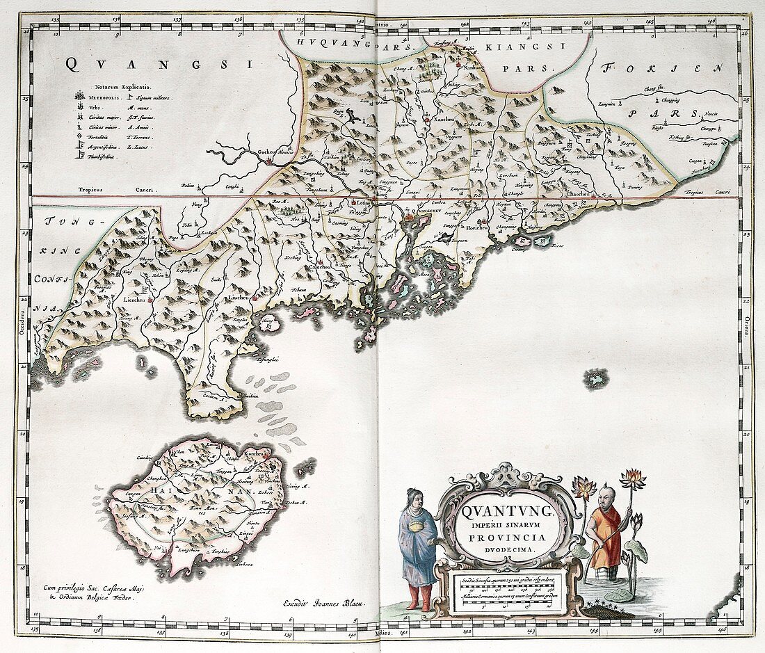
| Map of Guangdong and Hainan in China,17th century. The name of the imperial province is here given as 'Quantung'. The key at upper left indicates the size and type of settlements and military forts. The scale at lower right is in Chinese stadia and German miles. This map is from 'Novus atlas Sinensis' (1655) by Jesuit missionary and cartographer Martino Martini (1614-1661). This work was the most complete geographical description of China available to Europeans. | |
| Licence : | Droits gérés |
| Crédit: | Science Photo Library / Library of Congress,Geography and Map Division |
| Taille de l’image : | 3509 px × 2995 px |
| Model Release : | Non requis |
| Property Release : | Non requis |
| Restrictions : | - |
Prix pour cette image À partir de 45 €
Produit vendu
(Calendrier, Carte postale, Carte de vœux, Impression sur textile, Packaging etc)
À partir de 45 €
Usage commercial
(Affichage, Annonce presse, Annonce TV, Carte, Digital - hors rés. sociaux, Digital - rés. sociaux etc)
À partir de 45 €
Éditorial
(Digital, Journal, Livre, Livre pratique, Magazine, Télévision etc)
À partir de 60 €
Usage non-commercial
(Digital - hors rés. sociaux, Digital - rés. sociaux etc)
À partir de 120 €