Crops types in the Netherlands, satellite image
Numéro d’image : 12950702
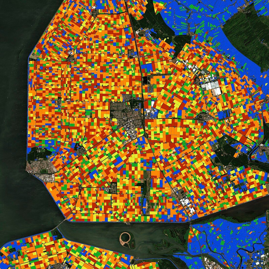
| Crops types in the Netherlands, satellite image. Green shows summer crops, red is potatoes, orange is market crops, yellow is cereals and blue depicts grassland. This area, around Emmeloord, is important for the agrofood sector and has strong ties to the international potato industry. This sort of satellite data is used by the industry to gain information about the growth and potential yield of crops, including the impact of ongoing droughts. Image data from 2018 obtained by the Copernicus Sentinel-2 satellites. | |
| Licence : | Droits gérés |
| Crédit: | Science Photo Library / GeoVille / Copernicus Sentinel data (2018) / EUROPEAN SPACE AGENCY |
| Taille de l’image : | 1535 px × 1535 px |
| Model Release : | Non requis |
| Property Release : | Non requis |
| Restrictions : |
|
Prix pour cette image À partir de 45 €
Produit vendu
(Calendrier, Carte postale, Carte de vœux, Impression sur textile, Packaging etc)
À partir de 45 €
Usage commercial
(Affichage, Annonce presse, Annonce TV, Carte, Digital - hors rés. sociaux, Digital - rés. sociaux etc)
À partir de 45 €
Éditorial
(Digital, Journal, Livre, Livre pratique, Magazine, Télévision etc)
À partir de 60 €
Usage non-commercial
(Digital - hors rés. sociaux, Digital - rés. sociaux etc)
À partir de 120 €
Mots clés
- 2018,
- 21ème siècle,
- agricole,
- agriculture,
- aucun,
- céréales,
- champ,
- champs,
- Copernic,
- de l'espace,
- Europe,
- européen,
- ferme,
- géographie,
- géographique,
- image satellite,
- néerlandais,
- observation de la terre,
- pâturage,
- Pays-Bas,
- personne,
- pommes de terre,
- prairie,
- production alimentaire,
- satellite,
- XX1ème siècle