Hawaiian island of Kauai, LiDAR satellite image
Numéro d’image : 12950688
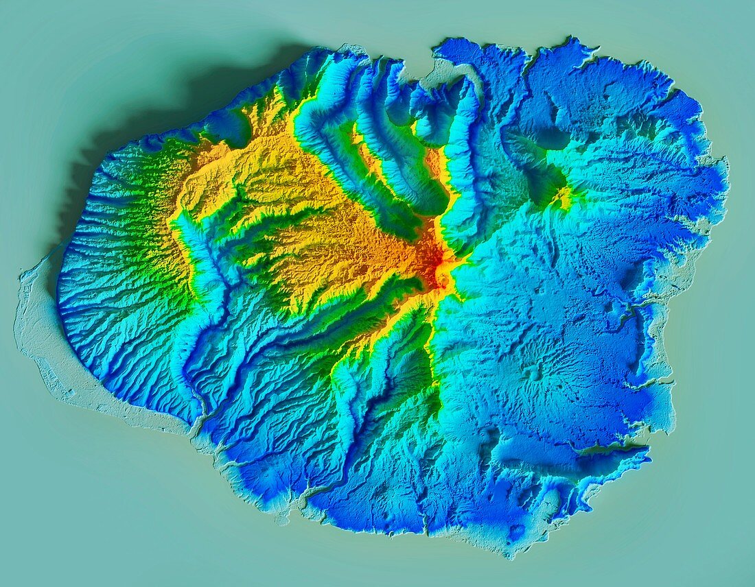
| Hawaiian island of Kauai, LiDAR satellite image. Geologically, this is the oldest of the Hawaiian island, with the volcanic peak classified as extinct. The peak (red) reaches an elevation of 1598 metres. LiDAR combines optical and laser imaging to produce digital elevation maps (DEMs), with differences in elevation shown by the colour-coding of the image. Image data obtained by the radar and optical sensors on the Advanced Land Observation Satellite (ALOS) of the Japan Aerospace Exploration Agency (JAXA). | |
| Licence : | Droits gérés |
| Crédit: | Science Photo Library / JAXA / MATTHEW HURST |
| Taille de l’image : | 4740 px × 3687 px |
| Model Release : | Non requis |
| Property Release : | Non requis |
| Restrictions : | - |
Prix pour cette image À partir de 45 €
Produit vendu
(Calendrier, Carte postale, Carte de vœux, Impression sur textile, Packaging etc)
À partir de 45 €
Usage commercial
(Affichage, Annonce presse, Annonce TV, Carte, Digital - hors rés. sociaux, Digital - rés. sociaux etc)
À partir de 45 €
Éditorial
(Digital, Journal, Livre, Livre pratique, Magazine, Télévision etc)
À partir de 60 €
Usage non-commercial
(Digital - hors rés. sociaux, Digital - rés. sociaux etc)
À partir de 120 €
Mots clés
- américain,
- aucun,
- carte topographique digitale,
- carte topographique numérique,
- de l'espace,
- Etats-Unis,
- géographie,
- géographique,
- géologie,
- géologique,
- Hawaï,
- Hawai'i,
- hawaïen,
- Hawaii,
- île,
- image satellite,
- Jaxa,
- Kauai,
- modèle altimétrique numérique,
- modèle numérique altimétrique,
- modèle numérique d'élévation,
- observation de la terre,
- pacifique,
- personne,
- USA,
- volcan,
- volcanique,
- vulcanologie