Hurricane Dorian over the Bahamas, satellite image
Numéro d’image : 12920058
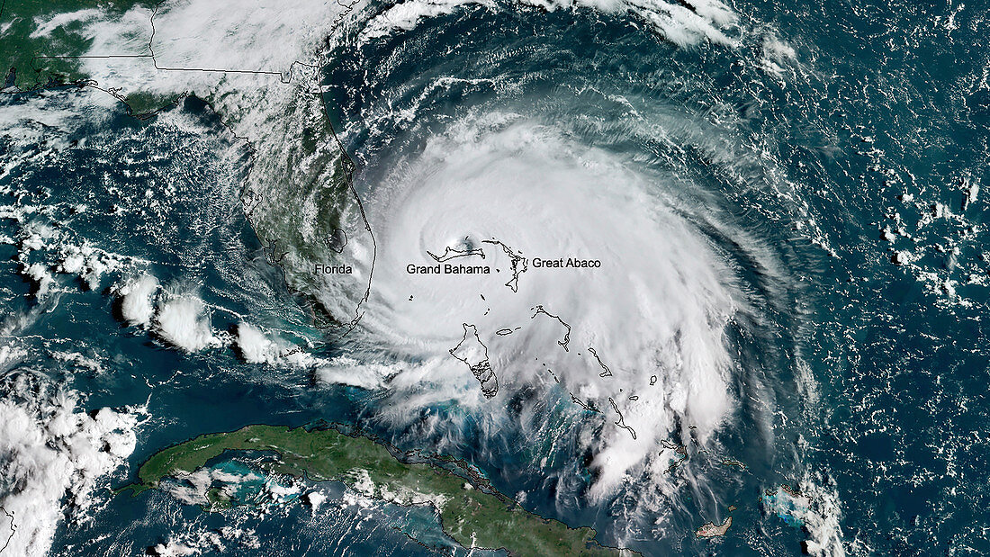
| Hurricane Dorian over the Bahamas, satellite image. Hurricane Dorian reached category 5 strength on 1 September 2019, making landfall in the Bahamas where it caused extensive damage and flooding due to high winds, prolonged rainfall and storm surges, especially on islands and associated islands of Great Abaco and Grand Bahama (labelled). This image was obtained by the GOES East (GOES-16) satellite on 2 September 2019. | |
| Licence : | Droits gérés |
| Crédit: | Science Photo Library / Environmental Visualization Laboratory / NOAA |
| Taille de l’image : | 3988 px × 2244 px |
| Model Release : | Non requis |
| Property Release : | Non requis |
| Restrictions : |
|
Prix pour cette image À partir de 45 €
Produit vendu
(Calendrier, Carte postale, Carte de vœux, Impression sur textile, Packaging etc)
À partir de 45 €
Usage commercial
(Affichage, Annonce presse, Annonce TV, Carte, Digital - hors rés. sociaux, Digital - rés. sociaux etc)
À partir de 45 €
Éditorial
(Digital, Journal, Livre, Livre pratique, Magazine, Télévision etc)
À partir de 60 €
Usage non-commercial
(Digital - hors rés. sociaux, Digital - rés. sociaux etc)
À partir de 120 €
Mots clés
- 2019,
- 21ème siècle,
- aucun,
- Bahamas,
- caraïbes,
- cyclone tropical,
- de l'espace,
- géographie,
- géographique,
- Grande Bahamas,
- image satellite,
- météo,
- météorologie,
- météorologique,
- observation de la terre,
- Océan Atlantique,
- ouragan,
- personne,
- satellite géostationnaire opérant environnement,
- satellite géostationnaire opérationel environnement,
- tempête,
- tempête cyclonique,
- XX1ème siècle