Okjokull dead glacier, satellite images
Numéro d’image : 12918513
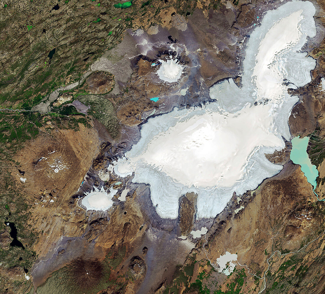
| Okjokull dead glacier in 219, Iceland, satellite image. Okjokull is the patches of thin ice and meltwater (blue) at left centre. In 1901 it was estimated that Okjokull covered an area of around 38 square kilometres. As the world warmed during the 20th century, the glacier was reduced by melting, and in 2014 it was declared dead as it no longer had enough mass to flow. Image obtained by the Operational Land Imager (OLI) on Landsat 8 on 1st August 2019. For an image of the glacier in 1986 see C047/1957. | |
| Licence : | Droits gérés |
| Crédit: | Science Photo Library / U.S. Geological Survey / NASA Earth Observatory, Joshua Stevens |
| Taille de l’image : | 3407 px × 3083 px |
| Model Release : | Non requis |
| Property Release : | Non requis |
| Restrictions : | - |
Prix pour cette image À partir de 45 €
Produit vendu
(Calendrier, Carte postale, Carte de vœux, Impression sur textile, Packaging etc)
À partir de 45 €
Usage commercial
(Affichage, Annonce presse, Annonce TV, Carte, Digital - hors rés. sociaux, Digital - rés. sociaux etc)
À partir de 45 €
Éditorial
(Digital, Journal, Livre, Livre pratique, Magazine, Télévision etc)
À partir de 60 €
Usage non-commercial
(Digital - hors rés. sociaux, Digital - rés. sociaux etc)
À partir de 120 €
Mots clés
- aucun,
- changement climatique,
- climatologie,
- climatologique,
- congelé,
- de l'espace,
- décès,
- fondu,
- gelé,
- géographie physique,
- géographique,
- glace,
- glaciaire,
- glacial,
- glacier,
- glaciologie,
- huiles,
- image satellite,
- imageur terrestre opérationnel,
- Islande,
- landsat 8,
- landsat huit,
- LDCM,
- mort,
- ok,
- OLI,
- Operational Land Imager,
- personne,
- réchauffement climatique,
- réduit,
- rétrèci,
- science de la terre,
- statique,
- surgelé