Greenland coastal mountains and ice, satellite image
Numéro d’image : 12331942
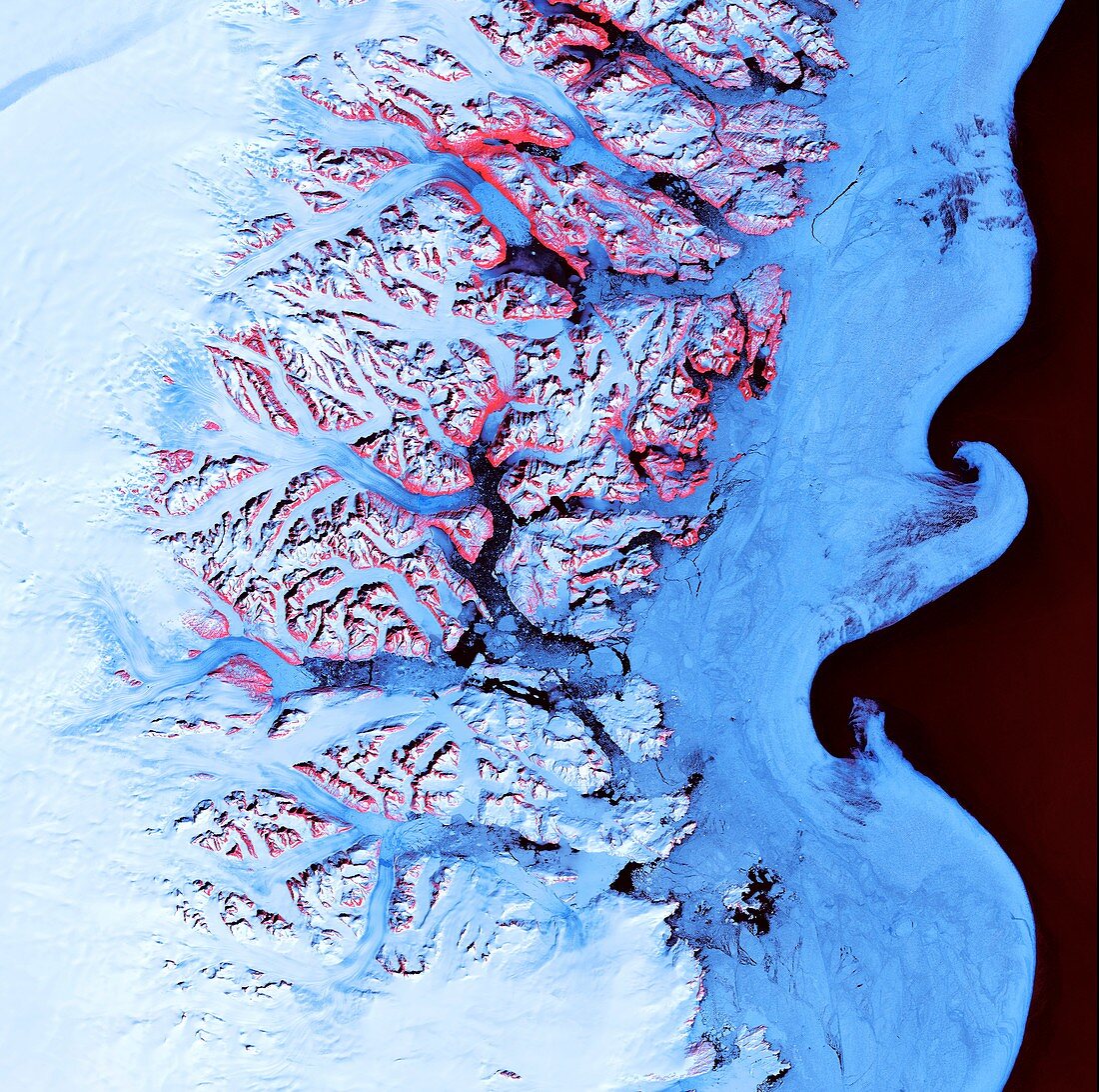
| Greenland coastal mountains and ice, satellite image. This region is on the south-eastern coast of Greenland, with numerous fjords funnelling glacial ice to the Atlantic Ocean. During the summer melting season, newly calved icebergs join slabs of sea ice and older, weathered icebergs in an offshore slurry that the southward-flowing East Greenland Current sculpts into the patterns seen here. The red areas are the exposed rock of mountain peaks. Image data obtained by the Landsat 7 satellite on 21 May 2001. | |
| Licence : | Droits gérés |
| Crédit: | Science Photo Library / US Geological Survey |
| Taille de l’image : | 4260 px × 4228 px |
| Model Release : | Non requis |
| Property Release : | Non requis |
| Restrictions : | - |
Prix pour cette image À partir de 45 €
Produit vendu
(Calendrier, Carte postale, Carte de vœux, Impression sur textile, Packaging etc)
À partir de 45 €
Usage commercial
(Affichage, Annonce presse, Annonce TV, Carte, Digital - hors rés. sociaux, Digital - rés. sociaux etc)
À partir de 45 €
Éditorial
(Digital, Journal, Livre, Livre pratique, Magazine, Télévision etc)
À partir de 60 €
Usage non-commercial
(Digital - hors rés. sociaux, Digital - rés. sociaux etc)
À partir de 120 €
Mots clés
- 2001,
- 21ème siècle,
- Arctique,
- Atlantique,
- aucun,
- côte,
- côtier,
- de l'espace,
- eau,
- fjord,
- Fjords,
- géographie,
- géographie physique,
- géographique,
- géologie,
- géologique,
- glace,
- glace de mer,
- glaciaire,
- glacial,
- glacier,
- glaciologie,
- Groenland,
- image satellite,
- Landsat,
- landsat 7,
- mer,
- modèle,
- modèles,
- montagne,
- montagnes,
- neige,
- observation de la terre,
- personne,
- satellite,
- XX1ème siècle