Byrd Glacier, satellite image
Numéro d’image : 12331939
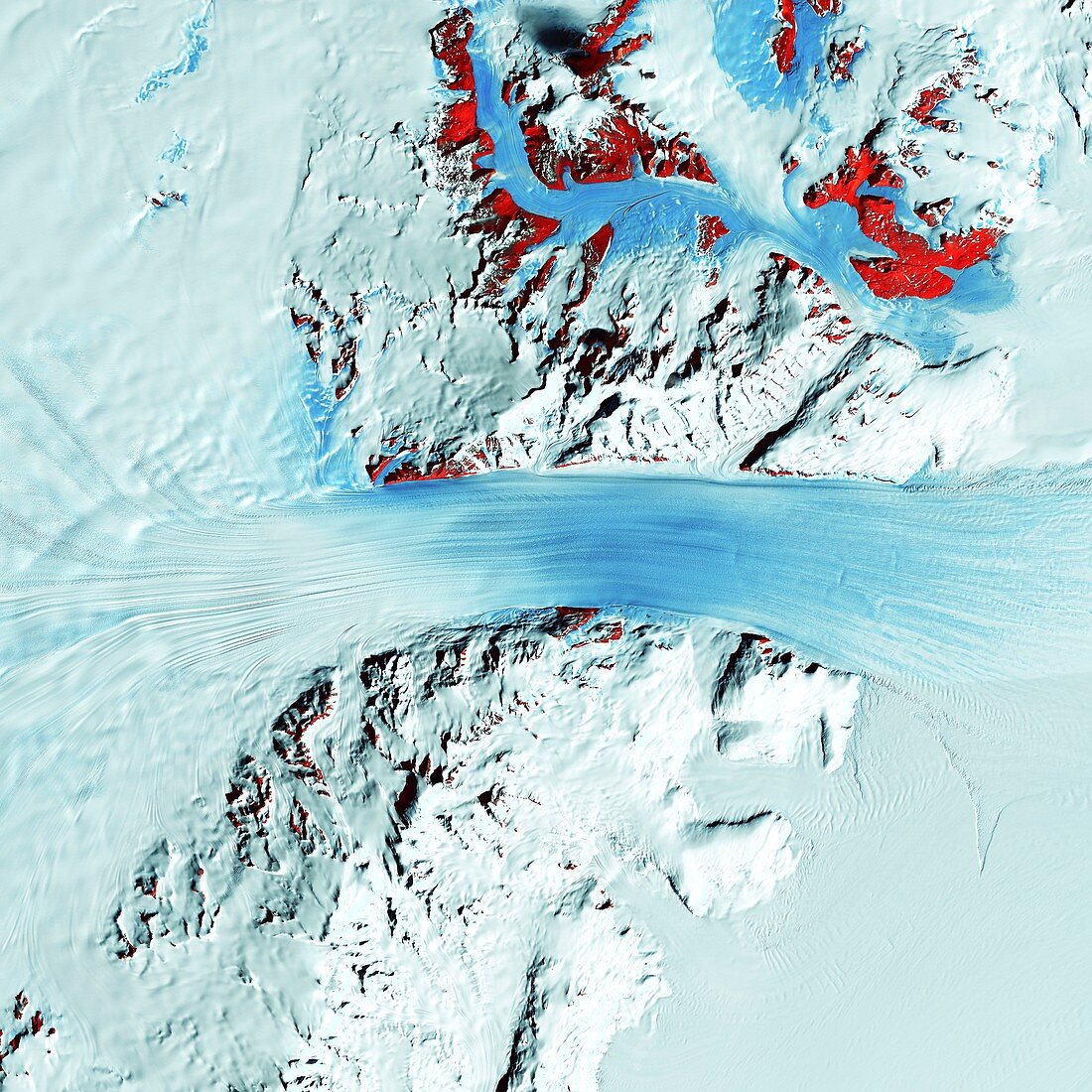
| Byrd Glacier, satellite image. The Byrd Glacier in Antarctic moves through the Transantarctic Mountains at a rate of 0.8 kilometres per year. More than 180 kilometres long, the glacier flows down from the polar plateau (left) to the Ross Ice Shelf (right). Long, sweeping flow lines are crossed in places by much shorter lines, which are deep cracks in the ice called crevasses. The red patches are areas of exposed rock. Image data obtained by the Landsat 7 satellite on 11 January 2000. | |
| Licence : | Droits gérés |
| Crédit: | Science Photo Library / US Geological Survey |
| Taille de l’image : | 4252 px × 4252 px |
| Model Release : | Non requis |
| Property Release : | Non requis |
| Restrictions : | - |
Prix pour cette image À partir de 45 €
Produit vendu
(Calendrier, Carte postale, Carte de vœux, Impression sur textile, Packaging etc)
À partir de 45 €
Usage commercial
(Affichage, Annonce presse, Annonce TV, Carte, Digital - hors rés. sociaux, Digital - rés. sociaux etc)
À partir de 45 €
Éditorial
(Digital, Journal, Livre, Livre pratique, Magazine, Télévision etc)
À partir de 60 €
Usage non-commercial
(Digital - hors rés. sociaux, Digital - rés. sociaux etc)
À partir de 120 €
Mots clés
- 2000,
- 21ème siècle,
- Antarctique,
- Antartica,
- aucun,
- congelé,
- crevasses,
- de l'espace,
- écoulement,
- fissures,
- froid,
- gelé,
- géographie,
- géographie physique,
- géographique,
- géologie,
- géologique,
- glace,
- glacé,
- glaciaire,
- glacial,
- glacier,
- glaciologie,
- image satellite,
- Landsat,
- landsat 7,
- montagne,
- montagnes,
- neige,
- observation de la terre,
- personne,
- satellite,
- surgelé,
- verglacé,
- XX1ème siècle