Tollesbury managed realignment site, Essex, UK
Numéro d’image : 12249979
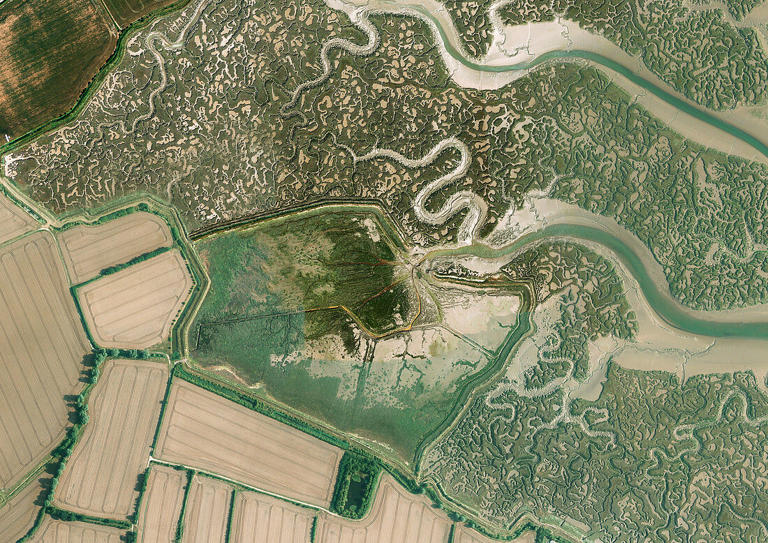
| Aerial photograph of Tollesbury managed realignment site, Essex, UK. Managed realignment involves allowing areas previously protected by flood-defences to flood. This creates new intertidal habitats and sustainable flood defences. The existing flood defences in Tollesbury were breached (centre) in August 1995. Since then the previously agricultural land has transformed to salt marshes and mud flats. Photographed in 2014. | |
| Licence : | Droits gérés |
| Crédit: | Science Photo Library / Getmapping Plc |
| Taille de l’image : | 7048 px × 4984 px |
| Model Release : | Non requis |
| Property Release : | Non requis |
| Restrictions : | - |
Prix pour cette image À partir de 45 €
Produit vendu
(Calendrier, Carte postale, Carte de vœux, Impression sur textile, Packaging etc)
À partir de 45 €
Usage commercial
(Affichage, Annonce presse, Annonce TV, Carte, Digital - hors rés. sociaux, Digital - rés. sociaux etc)
À partir de 45 €
Éditorial
(Digital, Journal, Livre, Livre pratique, Magazine, Télévision etc)
À partir de 60 €
Usage non-commercial
(Digital - hors rés. sociaux, Digital - rés. sociaux etc)
À partir de 120 €
Mots clés
- 2014,
- anglais,
- Angleterre,
- britannique,
- contrôle des inondations,
- côte,
- Côte Est,
- côtier,
- d'en haut,
- défense,
- du haut,
- Essex,
- Europe,
- européen,
- expérience,
- expérimental,
- expérimentale,
- Grande Bretagne,
- Grande-Bretagne,
- intercotidal,
- intertidal,
- photo aérienne,
- photographie aérienne,
- plongeant,
- Royaume Uni,
- Royaume-Uni