Wright-Molyneux world map, 16th century
Numéro d’image : 12249118
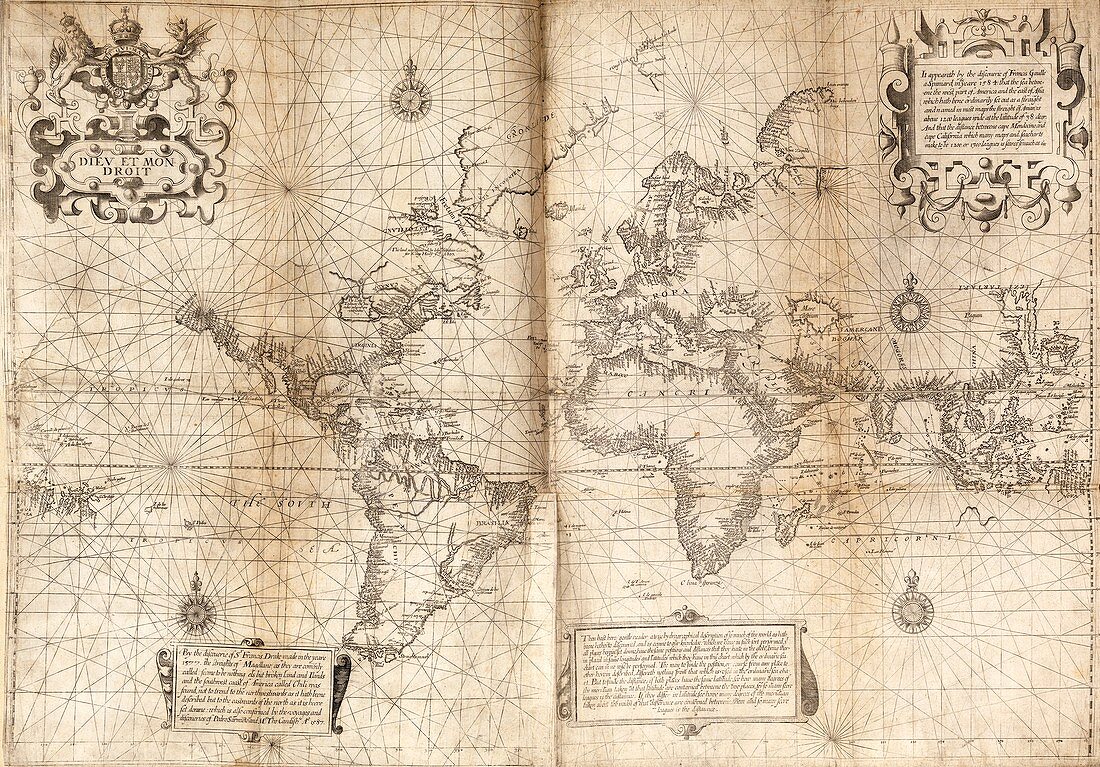
| Wright-Molyneux world map, 16th century. This map, which uses the Mercator projection, was produced by Edward Wright (1561-1615) and engraved by Emery Molyneux. This is a copy of the second state of the map. The text at top right describes the discoveries of the Spanish naval officer Francis Gaulle (Francisco de Gali) in 1584. The text at lower left describes the discoveries of English navigator Francis Drake in 1577, as well as further discoveries in 1587. The text at lower centre is addressed to the 'gentle reader' and describes how to calculate distances. This map is from the 1598-1600 edition of 'Principal Navigations' (1589) by Richard Hakluyt. | |
| Licence : | Droits gérés |
| Crédit: | Science Photo Library / Middle Temple Library |
| Taille de l’image : | 5527 px × 3852 px |
| Model Release : | Non requis |
| Property Release : | Non requis |
| Restrictions : | - |
Prix pour cette image À partir de 45 €
Produit vendu
(Calendrier, Carte postale, Carte de vœux, Impression sur textile, Packaging etc)
À partir de 45 €
Usage commercial
(Affichage, Annonce presse, Annonce TV, Carte, Digital - hors rés. sociaux, Digital - rés. sociaux etc)
À partir de 45 €
Éditorial
(Digital, Journal, Livre, Livre pratique, Magazine, Télévision etc)
À partir de 60 €
Usage non-commercial
(Digital - hors rés. sociaux, Digital - rés. sociaux etc)
À partir de 120 €
Mots clés
- 1500,
- 1589,
- 1598,
- 1599,
- 1600,
- 16ème siècle,
- aucun,
- brun,
- cartographie,
- cartographique,
- continent,
- EDWARD WRIGHT,
- Francis Drake,
- FRANCIS GAULLE,
- FRANCISCO DE GALI,
- géographie,
- géographique,
- histoire,
- historique,
- illustration,
- mer,
- monochrome,
- océan,
- Océan Atlantique,
- Océan Indien,
- Océan Pacifique,
- oeuvre,
- personne,
- sépia,
- XVIème siècle