North America
Numéro d’image : 12056811
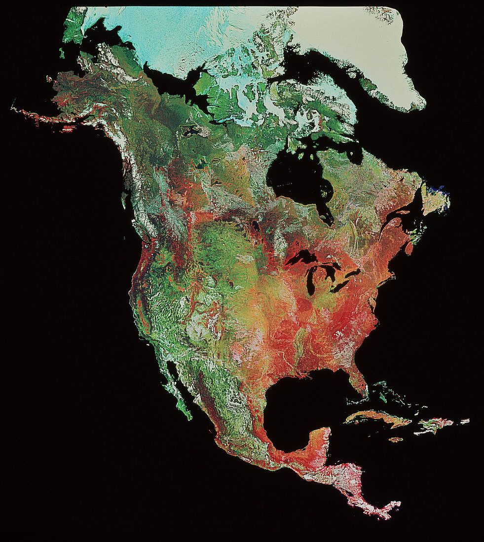
| North America. Coloured satellite image of North America. At the top of the picture are the Arctic Sea (white,left) and Greenland (right). At the bottom is Panama. This is a mosaic of hundreds of individual satellite images taken by the US National Oceanic and Atmospheric Administration (NOAA) weather satellites. The instrument used to collect the data (called the advanced very high resolution radiometer) collects a mixture of wavelengths including visible light and infrared radiation | |
| Licence : | Droits gérés |
| Crédit: | Science Photo Library / Terranova International |
| Taille de l’image : | 3534 px × 3961 px |
| Model Release : | Non requis |
| Property Release : | Non requis |
| Restrictions : |
|
Prix pour cette image À partir de 45 €
Produit vendu
(Calendrier, Carte postale, Carte de vœux, Impression sur textile, Packaging etc)
À partir de 45 €
Usage commercial
(Affichage, Annonce presse, Annonce TV, Carte, Digital - hors rés. sociaux, Digital - rés. sociaux etc)
À partir de 45 €
Éditorial
(Digital, Journal, Livre, Livre pratique, Magazine, Télévision etc)
À partir de 60 €
Usage non-commercial
(Digital - hors rés. sociaux, Digital - rés. sociaux etc)
À partir de 120 €
Mots clés
- Alaska,
- Amérique du Nord,
- baie d'Hudson,
- baie de Hudson,
- Californie,
- Canada,
- continent,
- de l'espace,
- Floride,
- géographie,
- grands Lacs,
- image de Noaa,
- image satellite,
- imagerie satellitaire,
- imagerie satellite,
- images,
- images du satellite Noaa,
- imagine de Landsat,
- labrador,
- Les Rocheuses,
- Mer des Caraïbes,
- Mexique,
- Montagnes Rocheuses,
- photo,
- photos,
- programme de Landsat,
- science de la terre,
- sciences,
- USA