Map of Liberia,1830
Numéro d’image : 11946506
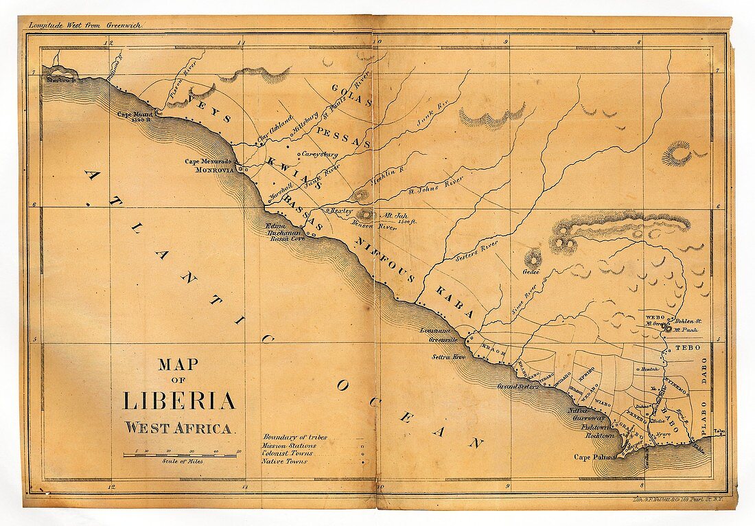
| Map of Liberia. 19th-century map of Liberia in West Africa as it appeared in 1830. The first settlement here was by the American Colonization Society in 1822,founded by slaveholders as a colony for free-born American black people. The Republic of Liberia declared independence in 1847,recognised by the USA in 1862. The capital is Monrovia (upper left). This map shows rivers,missionary stations,tribal boundaries,and colonial and indigenous settlements. Tribes named include the Veys,Kwias,Golas,Pessas,Bassas,Niffous and Kaba. The northern and southern borders are at Cape Mount (top left) and the Cavalla River (bottom right) | |
| Licence : | Droits gérés |
| Crédit: | Science Photo Library / LIBRARY OF CONGRESS, Geography and Map Division |
| Taille de l’image : | 5009 px × 3487 px |
| Model Release : | Non requis |
| Property Release : | Non requis |
| Restrictions : | - |
Prix pour cette image À partir de 45 €
Produit vendu
(Calendrier, Carte postale, Carte de vœux, Impression sur textile, Packaging etc)
À partir de 45 €
Usage commercial
(Affichage, Annonce presse, Annonce TV, Carte, Digital - hors rés. sociaux, Digital - rés. sociaux etc)
À partir de 45 €
Éditorial
(Digital, Journal, Livre, Livre pratique, Magazine, Télévision etc)
À partir de 60 €
Usage non-commercial
(Digital - hors rés. sociaux, Digital - rés. sociaux etc)
À partir de 120 €
Mots clés
- 1800,
- 1830,
- 19ème siècle,
- africain,
- Afrique,
- Afrique de l'Ouest,
- années 1800,
- Atlantique,
- aucun,
- autochtone,
- BASSAS,
- carte,
- cartographie,
- colonial,
- colonies,
- côte,
- côtes,
- côtier,
- esclaves,
- état,
- frontières,
- géographie,
- géographique,
- histoire,
- historique,
- illustration,
- indigène,
- Libéria,
- libre,
- limites,
- littoral,
- littoraux,
- nation,
- oeuvre,
- pays,
- personne,
- rivages,
- rivières,
- tribal,
- tribus,
- villes,
- XIXème siècle