Remote sensing satellite
Numéro d’image : 11889137
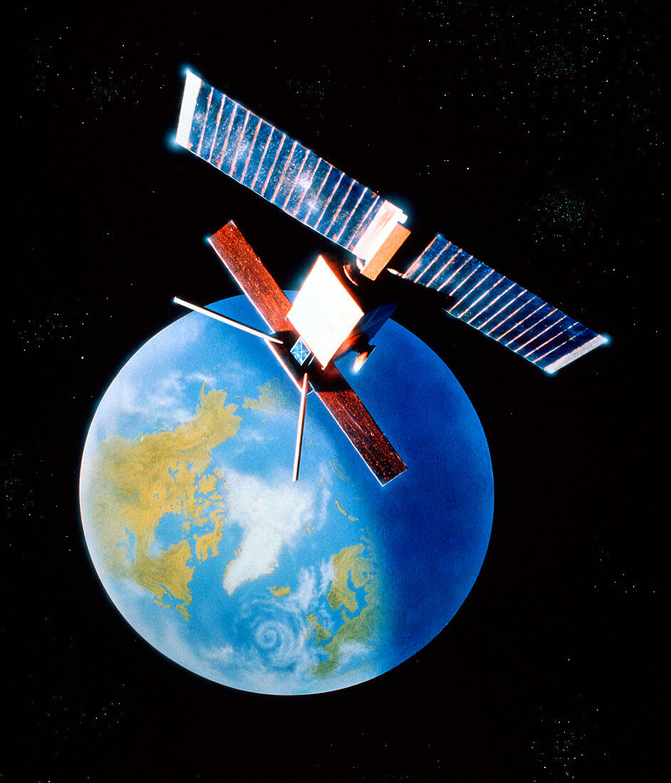
| Artist's impression of the European Remote-sensing Satellite (ERS-1) in orbit over the north pole. Due for launch in April 1991,ERS-1 is equipped with all-weather microwave and radar instruments which will be used primarily to study coastal,ocean and polar ice processes. The picture shows ERS-1's solar panels at top & its long Synthetic Aperture Radar antenna facing Earth. ERS-1 will play a major role in international satellite investigations into climate change,the so-called "Mission to Planet Earth". It will map ocean waves,currents and tides; global sea-surface temperatures and winds; ocean floor topography and sea ice distribution | |
| Licence : | Droits gérés |
| Crédit: | Science Photo Library / Baum, Julian |
| Taille de l’image : | 3533 px × 4126 px |
| Model Release : | Non requis |
| Property Release : | Non requis |
| Restrictions : | - |
Prix pour cette image À partir de 45 €
Produit vendu
(Calendrier, Carte postale, Carte de vœux, Impression sur textile, Packaging etc)
À partir de 45 €
Usage commercial
(Affichage, Annonce presse, Annonce TV, Carte, Digital - hors rés. sociaux, Digital - rés. sociaux etc)
À partir de 45 €
Éditorial
(Digital, Journal, Livre, Livre pratique, Magazine, Télévision etc)
À partir de 60 €
Usage non-commercial
(Digital - hors rés. sociaux, Digital - rés. sociaux etc)
À partir de 120 €