Martian canyon rim,3D image
Numéro d’image : 11882434
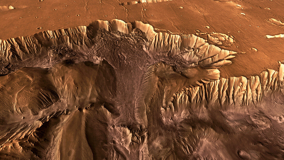
| Martian canyon rim,3D image based on satellite data. Perspective view of the rim of a canyon in Valles Marineris,the largest canyon system on Mars. The canyon system is thought to have been formed by a combination of tectonic activity and water erosion. The canyon walls are many kilometres high. This image was generated using infrared data from the Mars Odyssey spacecraft's Thermal Emission Imaging System,and topographical data from the Mars Global Surveyor spacecraft's Mars Orbiter Laser Altimeter,both of which are in orbit around Mars | |
| Licence : | Droits gérés |
| Crédit: | Science Photo Library / ARIZONA STATE UNIVERSITY / JPL / NASA |
| Taille de l’image : | 3945 px × 2219 px |
| Model Release : | Non requis |
| Property Release : | Non requis |
| Restrictions : | - |
Prix pour cette image À partir de 45 €
Produit vendu
(Calendrier, Carte postale, Carte de vœux, Impression sur textile, Packaging etc)
À partir de 45 €
Usage commercial
(Affichage, Annonce presse, Annonce TV, Carte, Digital - hors rés. sociaux, Digital - rés. sociaux etc)
À partir de 45 €
Éditorial
(Digital, Journal, Livre, Livre pratique, Magazine, Télévision etc)
À partir de 60 €
Usage non-commercial
(Digital - hors rés. sociaux, Digital - rés. sociaux etc)
À partir de 120 €
Mots clés
- altimètre laser de l'orbiteur de Mars,
- canyon,
- canyons,
- falaise,
- falaises,
- géologie,
- géologique,
- infrarouge,
- IR,
- Mars,
- Mars global surveyor,
- MGS,
- mola,
- Odyssée Mars,
- orange,
- ordinateur,
- perspective,
- planétaire,
- planète,
- point de vue,
- roches,
- rocheux,
- satellite,
- science planétaire,
- topographie,
- topographique,
- vallée,
- vallée Mariner,
- vallées,
- valles marineris