Valles Marineris on Mars
Numéro d’image : 11882281
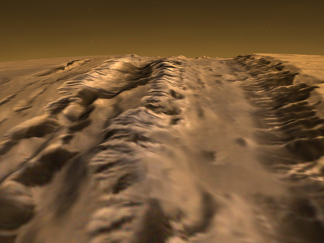
| Valles Marineris on Mars. Three-dimensional computer image based on Mars Global Surveyor (MGS) data of part of the large Valles Marineris valley system on Mars. This is the largest known valley system in the solar system,stretching for over 5000 kilometres across the surface of Mars. It was caused by geological activity in Mars' past. Extensive erosion by wind and water has also contributed to its topography. This image is derived from measurements taken by the Mars Orbiter Laser Altimeter (MOLA) on the MGS spacecraft in orbit around Mars | |
| Licence : | Droits gérés |
| Crédit: | Science Photo Library / NASA |
| Taille de l’image : | 2560 px × 1920 px |
| Model Release : | Non requis |
| Property Release : | Non requis |
| Restrictions : | - |
Prix pour cette image À partir de 45 €
Produit vendu
(Calendrier, Carte postale, Carte de vœux, Impression sur textile, Packaging etc)
À partir de 45 €
Usage commercial
(Affichage, Annonce presse, Annonce TV, Carte, Digital - hors rés. sociaux, Digital - rés. sociaux etc)
À partir de 45 €
Éditorial
(Digital, Journal, Livre, Livre pratique, Magazine, Télévision etc)
À partir de 60 €
Usage non-commercial
(Digital - hors rés. sociaux, Digital - rés. sociaux etc)
À partir de 120 €