Martian topography
Numéro d’image : 11882274
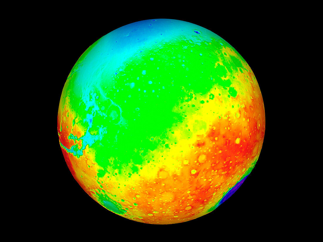
| Martian topography. Three-dimensional map of the topography of Mars. Elevation is colour-coded,from red (highest) through yellow,green and blue to purple (lowest). The Martian equator runs across centre. The huge Hellas Planitia impact basin (purple) is on the limb at lower right. At lower left is the smaller Argyre Planitia impact basin (green). At centre left is the eastern end of the Valles Marineris valley system (light blue),which extends for over 5000 kilometres. Data collected by the Mars Orbiter Laser Altimeter (MOLA) on the Mars Global Surveyor spacecraft. 27 million height measurements were made by timing laser pulses sent to Mars' surface | |
| Licence : | Droits gérés |
| Crédit: | Science Photo Library / NASA |
| Taille de l’image : | 2560 px × 1920 px |
| Model Release : | Non requis |
| Property Release : | Non requis |
| Restrictions : | - |
Prix pour cette image À partir de 45 €
Produit vendu
(Calendrier, Carte postale, Carte de vœux, Impression sur textile, Packaging etc)
À partir de 45 €
Usage commercial
(Affichage, Annonce presse, Annonce TV, Carte, Digital - hors rés. sociaux, Digital - rés. sociaux etc)
À partir de 45 €
Éditorial
(Digital, Journal, Livre, Livre pratique, Magazine, Télévision etc)
À partir de 60 €
Usage non-commercial
(Digital - hors rés. sociaux, Digital - rés. sociaux etc)
À partir de 120 €