3-D image of the global topography of Mars
Numéro d’image : 11882264
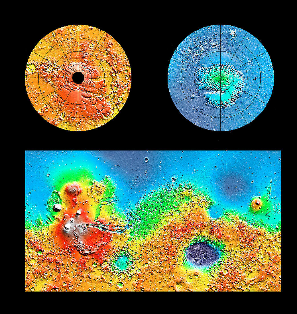
| Mars global topography. Three-dimensional map of Mars showing the topography of the entire planet as plotted by the Mars Global Surveyor spacecraft. Colour-coding shows elevation of the surface relative to the average surface height at the equator. Yellow areas are average elevation,while red is higher,and green to blue lower. South (at left) and north (right) poles are at upper frame; the rectangular image shows the majority of the planet. This data was recorded by the Mars Orbiter Laser Altimeter (MOLA) on board the Mars Global Surveyor spacecraft. Up to 27 million measurements accurate to within 13 metres were made in 1998 and 1999 by timing laser pulses sent to Mars' surface | |
| Licence : | Droits gérés |
| Crédit: | Science Photo Library / NASA |
| Taille de l’image : | 2500 px × 2640 px |
| Model Release : | Non requis |
| Property Release : | Non requis |
| Restrictions : | - |
Prix pour cette image À partir de 45 €
Produit vendu
(Calendrier, Carte postale, Carte de vœux, Impression sur textile, Packaging etc)
À partir de 45 €
Usage commercial
(Affichage, Annonce presse, Annonce TV, Carte, Digital - hors rés. sociaux, Digital - rés. sociaux etc)
À partir de 45 €
Éditorial
(Digital, Journal, Livre, Livre pratique, Magazine, Télévision etc)
À partir de 60 €
Usage non-commercial
(Digital - hors rés. sociaux, Digital - rés. sociaux etc)
À partir de 120 €