Mars' north pole
Numéro d’image : 11882261
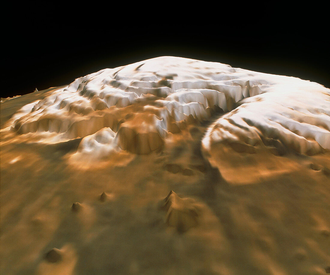
| Mars' north pole. Computer image of Mars' north polar ice cap,based on data collected in mid-1998 from the laser altimeter on the Global Surveyor spacecraft in orbit around Mars. The Mars Orbiter Laser Altimeter (MOLA) fired around 2.6 million laser pulses at the pole,measuring the return time of each one to ascertain the surface topography. The map has a resolution of one kilometre and a vertical accuracy of between 5 and 30 metres. The ice cap is around 1200 kilometres across,and over 3 kilometres thick. The deeper canyons plunge over a kilometre down from the surface. It is composed of water ice,an essential resource for any manned missions landing on Mars | |
| Licence : | Droits gérés |
| Crédit: | Science Photo Library / NASA |
| Taille de l’image : | 4121 px × 3431 px |
| Model Release : | Non requis |
| Property Release : | Non requis |
| Restrictions : | - |
Prix pour cette image À partir de 45 €
Produit vendu
(Calendrier, Carte postale, Carte de vœux, Impression sur textile, Packaging etc)
À partir de 45 €
Usage commercial
(Affichage, Annonce presse, Annonce TV, Carte, Digital - hors rés. sociaux, Digital - rés. sociaux etc)
À partir de 45 €
Éditorial
(Digital, Journal, Livre, Livre pratique, Magazine, Télévision etc)
À partir de 60 €
Usage non-commercial
(Digital - hors rés. sociaux, Digital - rés. sociaux etc)
À partir de 120 €