Sapas Mons volcano,Atla Regio,Venus Magellan pic
Numéro d’image : 11881737
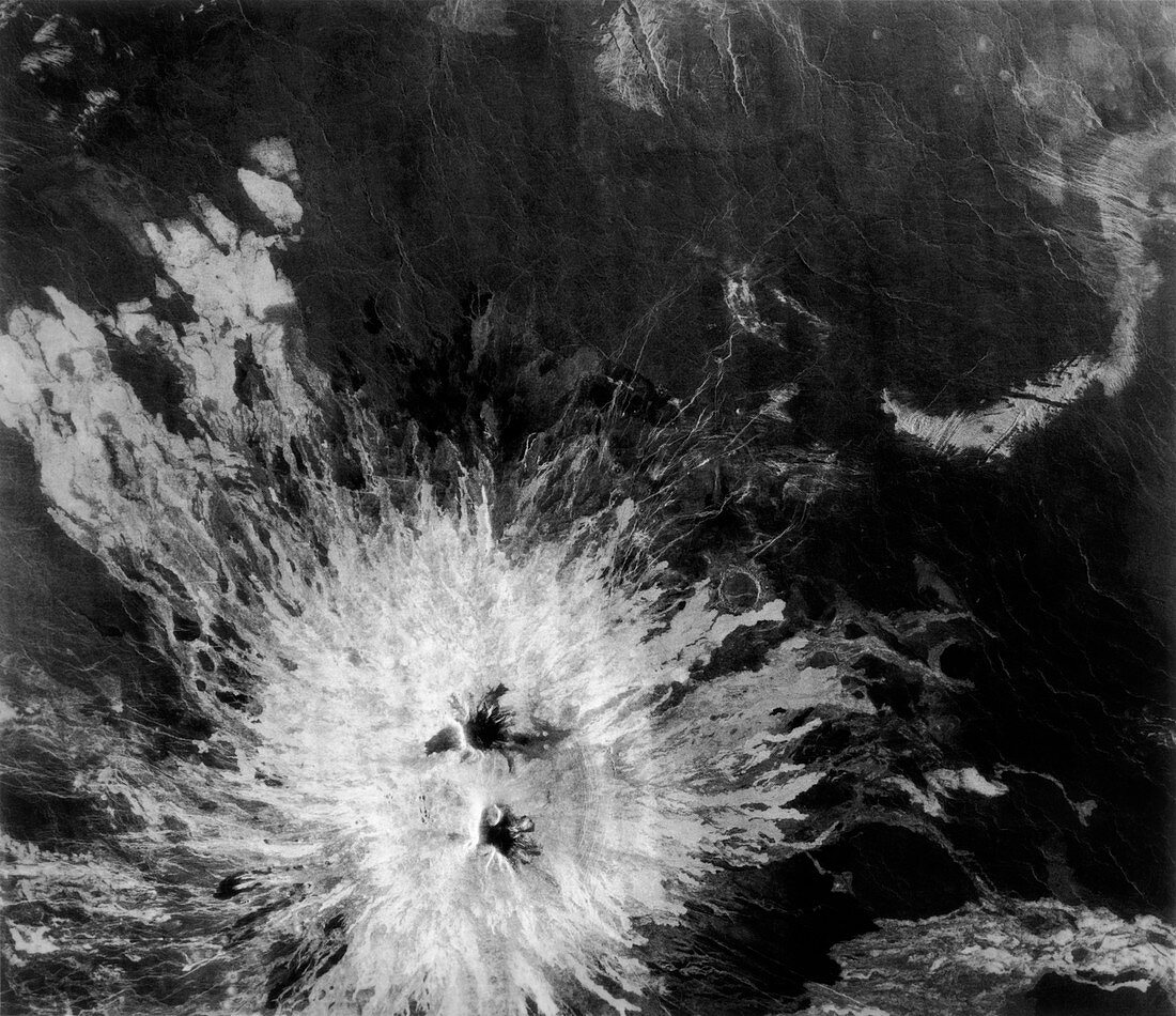
| Radar image of Sapas Mons volcano,Venus. The bulk of the volcano is seen as the radar-bright area at the bottom of the frame. This indicates large lava flows. At the top right edge of the volcano is a large circular impact crater. Many of the flows seem to have originated from the flanks of the volcano,rather than the cone. This type of pattern is seen in Hawaiian-type volcanoes on Earth. Sapas Mons is about 400 kilometers across at its base,and rises 1.5 km above the local terrain. It is located within the Atla Regio,a broad equatorial rise at 188 degrees east longitude. The data for this image were gathered by the Magellan radar-mapping spacecraft in 1991 | |
| Licence : | Droits gérés |
| Crédit: | Science Photo Library / NASA |
| Taille de l’image : | 4531 px × 3914 px |
| Model Release : | Non requis |
| Property Release : | Non requis |
| Restrictions : | - |
Prix pour cette image À partir de 45 €
Produit vendu
(Calendrier, Carte postale, Carte de vœux, Impression sur textile, Packaging etc)
À partir de 45 €
Usage commercial
(Affichage, Annonce presse, Annonce TV, Carte, Digital - hors rés. sociaux, Digital - rés. sociaux etc)
À partir de 45 €
Éditorial
(Digital, Journal, Livre, Livre pratique, Magazine, Télévision etc)
À partir de 60 €
Usage non-commercial
(Digital - hors rés. sociaux, Digital - rés. sociaux etc)
À partir de 120 €