Baghdad,Iraq,satellite image
Numéro d’image : 11748787
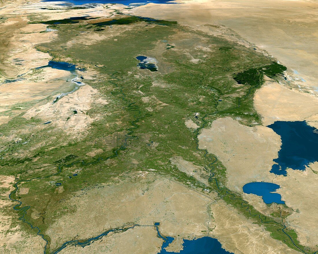
| Baghdad,capital city of Iraq,satellite image. North is towards bottom left. Baghdad is the built-up area (brown) on the Tigris River just left of centre. It occupies the large fertile area (green) that lies between the Tigris and the Euphrates (down right) rivers,an area formerly called Mesopotamia. The large lake at far right is Lake Razazah,with the smaller Habbaniyah at lower right. At bottom right is the southern part of Lake Tharthar. The northern tip of the Persian Gulf is seen at top left | |
| Licence : | Droits gérés |
| Crédit: | Science Photo Library / Worldsat International |
| Taille de l’image : | 4200 px × 3360 px |
| Model Release : | Non requis |
| Property Release : | Non requis |
| Restrictions : |
|
Prix pour cette image À partir de 45 €
Produit vendu
(Calendrier, Carte postale, Carte de vœux, Impression sur textile, Packaging etc)
À partir de 45 €
Usage commercial
(Affichage, Annonce presse, Annonce TV, Carte, Digital - hors rés. sociaux, Digital - rés. sociaux etc)
À partir de 45 €
Éditorial
(Digital, Journal, Livre, Livre pratique, Magazine, Télévision etc)
À partir de 60 €
Usage non-commercial
(Digital - hors rés. sociaux, Digital - rés. sociaux etc)
À partir de 120 €