Infrared satellite image of Baghdad,Iraq
Numéro d’image : 11748727
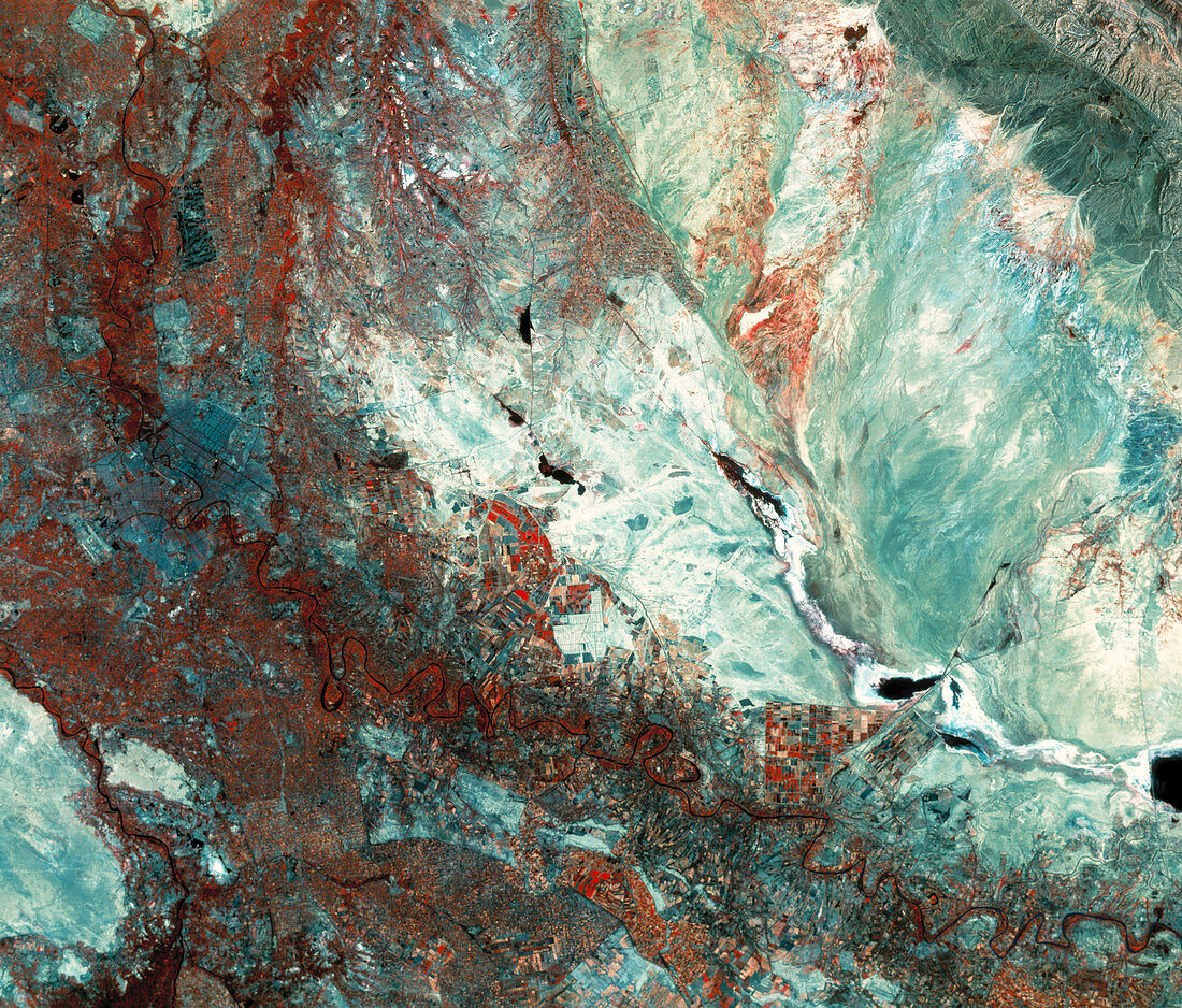
| Baghdad. Infrared satellite image of Baghdad (centre left),the capital of Iraq. North is towards top left. Vegetation appears red,water black,urban areas grey/blue and bare ground blue/ white. Running through the centre of the city is the River Tigris. The River Euphrates is at lower left. The Syrian Desert begins at bottom left. To the southwest of the city is a large airport. The irrigated fields (red) in the fertile plain surrounding Baghdad have a patchwork appearance. The Zagros Mountains are at top right. This image was taken by an American Landsat satellite in June 1990. The image covers an area of 200 by 170 kms | |
| Licence : | Droits gérés |
| Crédit: | Science Photo Library / MDA Information Systems |
| Taille de l’image : | 4121 px × 3515 px |
| Model Release : | Non requis |
| Property Release : | Non requis |
| Restrictions : | - |
Prix pour cette image À partir de 45 €
Produit vendu
(Calendrier, Carte postale, Carte de vœux, Impression sur textile, Packaging etc)
À partir de 45 €
Usage commercial
(Affichage, Annonce presse, Annonce TV, Carte, Digital - hors rés. sociaux, Digital - rés. sociaux etc)
À partir de 45 €
Éditorial
(Digital, Journal, Livre, Livre pratique, Magazine, Télévision etc)
À partir de 60 €
Usage non-commercial
(Digital - hors rés. sociaux, Digital - rés. sociaux etc)
À partir de 120 €