Coloured radar image of agriculture in the Ukraine
Numéro d’image : 11747717
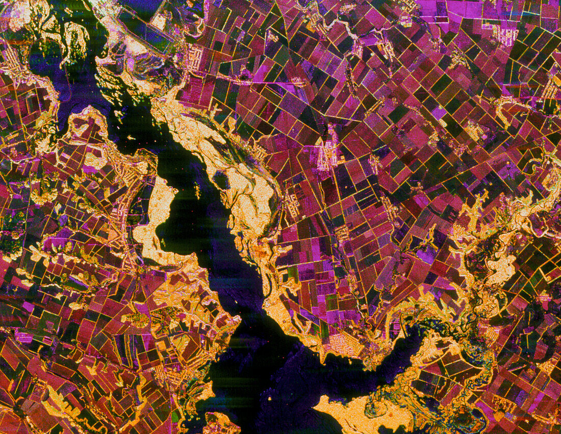
| Agriculture from space. Coloured radar satellite image of farmland used for mechanised agriculture along the banks of a major river (black). North is at top right. On this image the fields are purple and brown,showing that they do not have active crops; the fields are used to grow cereals. The hedges between the fields appear yellow,as do the riverbank (riparian) forests. Radar images can be used to map crop types,monitor their health and predict yields. Image of the Dnieper river in the central Ukraine; the tributary flowing from far right is the Vorskla River. Image taken by the Spaceborne Imaging Radar-C aboard the US space shuttle Endeavour in April. Image area: 45kmx35km | |
| Licence : | Droits gérés |
| Crédit: | Science Photo Library / NASA |
| Taille de l’image : | 3543 px × 2742 px |
| Model Release : | Non requis |
| Property Release : | Non requis |
| Restrictions : | - |
Prix pour cette image À partir de 45 €
Produit vendu
(Calendrier, Carte postale, Carte de vœux, Impression sur textile, Packaging etc)
À partir de 45 €
Usage commercial
(Affichage, Annonce presse, Annonce TV, Carte, Digital - hors rés. sociaux, Digital - rés. sociaux etc)
À partir de 45 €
Éditorial
(Digital, Journal, Livre, Livre pratique, Magazine, Télévision etc)
À partir de 60 €
Usage non-commercial
(Digital - hors rés. sociaux, Digital - rés. sociaux etc)
À partir de 120 €